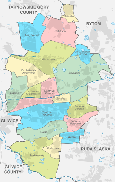
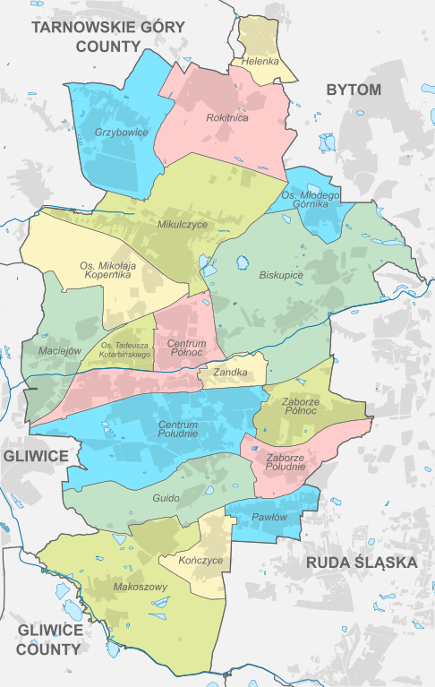
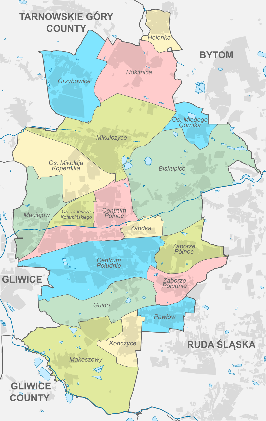
File:Zabrze Subdivisions.svg

Size of this PNG preview of this SVG file: 380 × 600 pixels. Other resolutions: 152 × 240 pixels | 304 × 480 pixels | 486 × 768 pixels | 648 × 1,024 pixels | 1,125 × 1,776 pixels.
Original file (SVG file, nominally 1,125 × 1,776 pixels, file size: 666 KB)
| This is a file from the Wikimedia Commons. The description on its description page there is shown below.
|
Summary
| Description |
English: Location of districts of Zabrze |
| Date | |
| Source |
Own work
|
| Author | SANtosito |
| SVG development |
Licensing
I, the copyright holder of this work, hereby publish it under the following license:
This file is licensed under the Creative Commons Attribution-Share Alike 4.0 International license.
- You are free:
- to share – to copy, distribute and transmit the work
- to remix – to adapt the work
- Under the following conditions:
- attribution – You must give appropriate credit, provide a link to the license, and indicate if changes were made. You may do so in any reasonable manner, but not in any way that suggests the licensor endorses you or your use.
- share alike – If you remix, transform, or build upon the material, you must distribute your contributions under the same or compatible license as the original.
File history
Click on a date/time to view the file as it appeared at that time.
| Date/Time | Dimensions | User | Comment | |
|---|---|---|---|---|
| current | 06:16, 27 May 2018 | 1,125 × 1,776 (666 KB) | Dżamper | Fix urban area in Rokitnica. |
File usage
The following page uses this file: