Nuristan Province
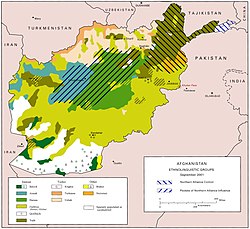
Nuristān (Persian: نورستان), also spelled Nurestān or Nooristan, is a region in Afghanistan. It is in the south of the Hindu Kush valleys. The capital is Parun. The ethnic composition is 96% Nuristanis, 2% Pashtuns and 2% Gujars.
|
نورستان | |
|---|---|
| 250px | |
| Map of Afghanistan with Nuristan highlighted Map of Afghanistan with Nuristan highlighted | |
| Coordinates: 35°15′N 70°45′E / 35.25°N 70.75°ECoordinates: 35°15′N 70°45′E / 35.25°N 70.75°E | |
| Country | |
| Provincial center | Parun |
| Government | |
| • Governor | Hafiz Muhammad Aagha |
| • Deputy Governor | Sheikh Ismatullah[1] |
| Area | |
| • Total | 9,225.0 km2 (3,561.8 sq mi) |
| Population (2021)[2] | |
| • Total | 166,676 |
| • Density | 18.06786/km2 (46.7955/sq mi) |
| Time zone | UTC+4:30 (Afghanistan Time) |
| ISO 3166 code | AF-NUR |
| Main languages | Nuristani languages Dari |
Districts
File:Nurestan districts.png
Districts of Nuristan.
| District | Center | Population [3] | Area[4] | Notes |
|---|---|---|---|---|
| Bargi Matal | ||||
| Du Ab | Est. 2004 formerly part of Nuristan District and Mangol District | |||
| Kamdesh | Kamdish | |||
| Mandol | Lost territory to Du Ab District in 2004 | |||
| Nurgram | Est. 2004 formerly part of Nuristan District and Wama District | |||
| Parun | Est. 2004 formerly part of Wama District | |||
| Wama | Lost territory to Parun District and Nurgram District in 2004 | |||
| Waygal |
Nuristan Province Media
A U.S. soldier moving along a path overlooking the mountainside village of Aranas while on patrol in 2006
Members of the Afghan National Army (ANA) during a U.S.-led patrol in Wadawu valley during Operation Silver Creek in August 2009
- Nurestan districts 2014.png
Added Du Ab district and Parun district to Rarelibra's Nurestan districts.png, changed Nuristan district to Nurgaram district
- Northern Afghanistan by Kamran Shukoor.jpg
Northern Afghanistan by Kamran Shukoor
References
- ↑ "د نورستان مرستیال والي وانټ وایګل ته سفر وکړ". bakhtarnews.af. https://bakhtarnews.af/ps/%D8%AF-%D9%86%D9%88%D8%B1%D8%B3%D8%AA%D8%A7%D9%86-%D9%85%D8%B1%D8%B3%D8%AA%DB%8C%D8%A7%D9%84-%D9%88%D8%A7%D9%84%D9%8A-%D9%88%D8%A7%D9%86%D9%BC-%D9%88%D8%A7%DB%8C%DA%AB%D9%84-%D8%AA%D9%87-%D8%B3%D9%81/.
- ↑ "Estimated Population of Afghanistan 2021–22" (PDF). National Statistic and Information Authority (NSIA). April 2021. Archived (PDF) from the original on June 24, 2021. Retrieved June 21, 2021.
- ↑ Nuristan provincial profile profile compiled by the National Area-Based Development Programme (NABDP) of the Ministry of Rural Rehabilitation and Development (MRRD)
- ↑ Afghanistan Geographic & Thematic Layers
