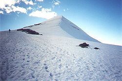
Scandinavian Mountains
The Scandinavian Mountains are a mountain range that runs through the Scandinavian Peninsula. The western sides of the mountains drop steeply into the North Sea and Norwegian Sea, where they form the fjords of Norway. To the north they form the border between Norway and Sweden, and passing across the Arctic Circle. A small part of the range runs into Finland, but this part mostly consists of hills.
| 280px | |
| Elevation | 2,469 m (8,100 ft)[1] |
|---|---|
| Location | |
Galdhøpiggen in southern Norway is the highest peak in the range, at 2,469 metres (8,100 ft). Kebnekaise has the highest peak on the Swedish side, at 2,104 m (6,903 ft). Halti is the highest peak in Finland, at 1,324 m (4,344 ft). The range's proximity to the Arctic and the North Atlantic ocean has caused the formation of many icefields and glaciers.
- Wiki Fig.jpg
Formation of the mountains of southern Norway (the Southern Scandes).
- Alpine permafrost in Scandinavia 05.jpg
Topographic map of the Jotunheimen and Dovre Rondane areas. Widespread alpine permafrost may be expected at the altitude of the -3.5°C MAAT (red). The glaciation limit (blue) shows the opposite trend.
- Overview Baltic shield.png
Simplified geological map of Fennoscandia. The Caledonian nappes are shown in green. Note the windows of bedrock belonging to the Transscandinavian Igneous Belt in blue. The Svecofennian and Sveconorwegian provinces are shown in yellow and salmon respectively.
Reconstruction of Europe during the Last Glacial Maximum of the Weichselian and Würm glaciations periods. note that the whole of the Scandinavian Mountains are covered with glacier ice (white).
Landscape as seen from Meekonvaara (1,019 m; 3,343 ft) towards the highest fells
Scandinavian Mountains, an Alpine Biogeographic Region as defined by the European Environment Agency and corrected by the Norwegian Directorate for Nature Management: red = Alpine region, yellow = Atlantic region, green = Boreal region, blue = Arctic region
Galdhøpiggen seen from west, Norway's highest mountain
References
- ↑ "Galdhøpiggen". Nationalencyklopedin (in svenska). Retrieved 18 July 2010.
Other websites
![]() Media related to Scandinavian Mountains (range) at Wikimedia Commons
Media related to Scandinavian Mountains (range) at Wikimedia Commons


