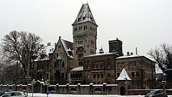
Stein, Bavaria
Stein (East Franconian: Schdah) is a town in Fürth, in Bavaria, Germany. It is 7 km south of Fürth, and 7 km southwest of Nuremberg (centre).
 | |
Coat of arms of Coat of arms | |
Location of Stein within Fürth district | |
| Coordinates: 49°25′N 11°1′E / 49.417°N 11.017°ECoordinates: 49°25′N 11°1′E / 49.417°N 11.017°E | |
| Country | Germany |
| State | Bavaria |
| Admin. region | Mittelfranken |
| District | Fürth |
| Subdivisions | 11 Stadtteile |
| Government | |
| • Mayor (2020–26) | Kurt Krömer[1] |
| Area | |
| • Total | 19.52 km2 (7.54 sq mi) |
| Highest elevation | 380 m (1,250 ft) |
| Lowest elevation | 300 m (1,000 ft) |
| Population (2016-12-31)[2] | |
| • Total | 13,828 |
| • Density | 708.40/km2 (1,834.8/sq mi) |
| Time zone | UTC+01:00 (CET) |
| • Summer (DST) | UTC+02:00 (CEST) |
| Postal codes | 90547 |
| Vehicle registration | FÜ |
| Website | www.stadt-stein.de |
Geography
Stein is in the metropolitan area Nürnberg/Fürth/Erlangen in Middle Franconia, Bavaria and is a part of the district of Fürth. It is next to Nuremberg in the north-west and is on the left bank of the river Rednitz. Neighboring municipalities are Nuremberg, Rohr, Roßtal, Zirndorf and Oberasbach.
Stein is divided into 11 districts:
|
|
References
| File:Wikivoyage-Logo-v3-icon.svg | Wikivoyage has a travel guide about: Stein bei Nürnberg |
- ↑ Liste der ersten Bürgermeister/Oberbürgermeister in kreisangehörigen Gemeinden, Bayerisches Landesamt für Statistik, 15 July 2021.
- ↑ "Fortschreibung des Bevölkerungsstandes". Bayerisches Landesamt für Statistik und Datenverarbeitung (in German). January 2018.
{{cite web}}: CS1 maint: unrecognized language (link)