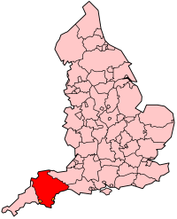
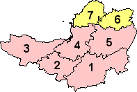
Template:Infobox England county/doc
| This is a documentation subpage for Template:Infobox England county. It contains usage information, categories and other content that is not part of the original template page. |
Usage
Copy and paste the code below into the article, then add the appropriate values to the fields. Comments (<!-- in these blocks -->) can be removed from the final code.
| Name of county | |
|---|---|
| Image (e.g. flag) - OPTIONAL | |
| Motto of County Council: Motto in original language followed by (Name of language: translation into English) - OPTIONAL | |

| |
| Geography | |
| Status | Status (ceremonial? administrative?) |
| Origin | Year of establishment (e.g. West Midlands = 1974) |
| Region | Government Office Region |
| Area - Total - Admin. council - Admin. area |
Ranked 4th 1,000 km2 (390 sq mi) Ranked 5th - OPTIONAL 950 km2 (370 sq mi) |
| Admin HQ | Wibbleton (not required if not an admin. county) - OPTIONAL |
| ISO 3166-2 | ISO 3166-2 code - OPTIONAL |
| ONS code | ONS code |
| NUTS 3 | NUTS 2/3 code |
| Demography | |
| Population - Total (2004) - Density - Admin. council - Admin. pop. |
Ranked 4th 1,000,000 254/km2 (660/sq mi) Ranked 5th - OPTIONAL 950,000 |
| Ethnicity | xx% White yy% Afro-Carib. zz% S. Asian |
| Politics | |
| The name http://www.and-website.gov.uk/ REMOVE THIS LINE FOR No county council | |
| Executive | |
| Members of Parliament |
|
| Remove this line for "Districts"; otherwise enter alternative name ("Metropolitan boroughs", etc.) | |

| |
{{Infobox England county
 | name =
 | image = <!-- Flag, etc. -- OPTIONAL -->
 | motto = <!-- OPTIONAL -->
 | map =
 | status =
 | origin = <!-- (year of establishment for "new" counties) OPTIONAL -->
 | region =
 | arearank =
 | area_km2 = <!--RAW Format only, no commas-->
 | adminarearank = <!-- OPTIONAL, REMOVE LINE IF NOT NEEDED -->
 | adminarea_km2 = <!-- RAW Format only, OPTIONAL, REMOVE LINE IF NOT NEEDED -->
 | adminhq = <!-- OPTIONAL, REMOVE LINE IF NOT NEEDED -->
 | iso = <!-- OPTIONAL -->
 | ons =
 | nutscode = <!-- NUTS x - (x = value entered, or leave blank for NUTS 3) - OPTIONAL -->
 | nuts3 =
 | poprank =
 | popestdate =
 | pop =
 | density_km2 = <!--RAW Format only, no commas-->
 | adminpoprank = <!-- OPTIONAL, REMOVE LINE IF NOT NEEDED -->
 | adminpop = <!-- OPTIONAL, REMOVE LINE IF NOT NEEDED -->
 | ethnicity =
 | council = <!-- Default value: No county council -- REMOVE LINE IF NOT NEEDED -->
 | mps =
 | subdivname = <!-- Default value: Districts -- REMOVE LINE IF NOT NEEDED -->
 | subdivmap =
 | subdivs =
}}
Microformat
The HTML mark up produced by this template includes an hCard microformat, which makes the place-name and location parsable by computers, either acting automatically to catalogue article across Wikipedia, or via a browser tool operated by a person, to (for example) add the subject to an address book. For more information about the use of microformats on Wikipedia, please see the microformat project.
hCard uses HTML classes including:
- "adr"
- "county-name"
- "fn"
- "label"
- "locality"
- "nickname"
- "note"
- "org"
- "vcard"
Please do not rename or remove these classes.