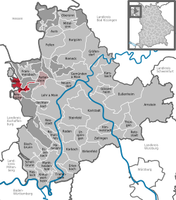
Wiesthal
Wiesthal is a community in the Main-Spessart district in the Regierungsbezirk of Lower Franconia (Unterfranken) in Bavaria, Germany and a member of the Verwaltungsgemeinschaft (municipal association) of Partenstein. It has a population of around 1,300.
| Coordinates: 50°2′N 9°26′E / 50.033°N 9.433°ECoordinates: 50°2′N 9°26′E / 50.033°N 9.433°E | |
| Country | Germany |
| State | Bavaria |
| Admin. region | Unterfranken |
| District | Main-Spessart |
| Municipal assoc. | Partenstein |
| Government | |
| • Mayor (2020–26) | Karl-Heinz Hofmann[1] (FW) |
| Area | |
| • Total | 9.18 km2 (3.54 sq mi) |
| Elevation | 250 m (820 ft) |
| Population (2016-12-31)[2] | |
| • Total | 1,323 |
| • Density | 144.12/km2 (373.3/sq mi) |
| Time zone | UTC+01:00 (CET) |
| • Summer (DST) | UTC+02:00 (CEST) |
| Postal codes | 97859 |
| Vehicle registration | MSP |
| Website | www.wiesthal.de |
Geography
Location
Wiesthal is in the Aschaffenburg region in the Aubach valley in the Mittelgebirge Spessart.
Subdivision
The community has the following Gemarkungen (traditional rural cadastral areas): Krommenthal and Wiesthal. These are also the two Ortsteile.
Wiesthal Media
References
- ↑ Liste der ersten Bürgermeister/Oberbürgermeister in kreisangehörigen Gemeinden, Bayerisches Landesamt für Statistik, 15 July 2021.
- ↑ "Fortschreibung des Bevölkerungsstandes". Bayerisches Landesamt für Statistik und Datenverarbeitung (in German). January 2018.
{{cite web}}: CS1 maint: unrecognized language (link)
Other websites
| Wikimedia Commons has media related to Lua error in Module:Commons_link at line 62: attempt to index field 'wikibase' (a nil value).. |
- Community’s official webpage (in German)


