Zoeterwoude
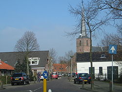
Zoeterwoude is a municipality in the Dutch province of South Holland. In 2019, 8,450 people lived there.
 | |
| Coordinates: 52°07′31.0″N 4°29′53.4″E / 52.125278°N 4.498167°E | |
| Country | |
| Province | |
| Government | |
| • Mayor | Fred van Trigt |
| Area | |
| • Total | 21.19 km2 (8.18 sq mi) |
| Population (January 1, 2001) | |
| • Total | 8,683 |
| • Density | 409.8/km2 (1,061/sq mi) |
| Time zone | UTC+01:00 |
| Postal code(s) | 2381, 2382, 2735 |
| MCN | 0638 |
| Website | Official website |


