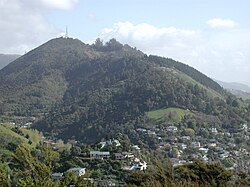
Bishopdale, Nelson
Bishopdale is a suburb of Nelson and it lies south of the Nelson city centre, inland from Wakatu at the foot of Grampians Reserve. There is no public transport available.
Suburb | |
 | |
| Lua error in Module:Infobox_mapframe at line 118: attempt to index field 'wikibase' (a nil value). | |
| Coordinates: 41°17′50″S 173°16′0″E / 41.29722°S 173.26667°E | |
| Country | New Zealand |
| Region | Nelson |
| Territorial authority | Nelson |
| Government | |
| • Nelson City Mayor | Nick Smith |
| • Nelson MP | Rachel Boyack |
| • Te Tai Tonga MP | Tākuta Ferris |
| Area | |
| • Total | 2.95 km2 (1.14 sq mi) |
| • Land | 2.95 km2 (1.14 sq mi) |
| • Water | 0 km2 (0 sq mi) |
| Population (June 2023) | |
| • Total | [1] |
| Time zone | UTC+12 (NZST) |
| • Summer (DST) | UTC+13 (NZDT) |
| Postcode | 7010 |
References
- ↑ "Population estimate tables - NZ.Stat". Statistics New Zealand. Retrieved 25 October 2023.