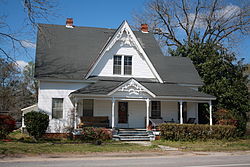
Coffeeville, Alabama
Coffeeville is a town in Clarke County, Alabama, United States. At the 2020 census, the population was 263.[2] The town was incorporated in 1817.[4]
 | |
| Location of Coffeeville in Clarke County, Alabama. Location of Coffeeville in Clarke County, Alabama. | |
| Coordinates: 31°45′29″N 88°05′23″W / 31.75806°N 88.08972°WCoordinates: 31°45′29″N 88°05′23″W / 31.75806°N 88.08972°W | |
| Country | United States |
| State | Alabama |
| County | Clarke |
| Area | |
| • Total | 4.52 sq mi (11.71 km2) |
| • Land | 4.52 sq mi (11.71 km2) |
| • Water | 0.00 sq mi (0.00 km2) |
| Elevation | 174 ft (53 m) |
| Population | |
| • Total | 263 |
| • Density | 58.19/sq mi (22.47/km2) |
| Time zone | UTC-6 (Central (CST)) |
| • Summer (DST) | UTC-5 (CDT) |
| ZIP code | 36524 |
| FIPS code | 01-16264 |
| GNIS feature ID | 116356[3] |
Geography
Coffeeville is located at 31°45'40.543" North, 88°5'20.940" West (31.761262, -88.089150),[5] on high ground on the east side of the Tombigbee River.
According to the U.S. Census Bureau, the town has a total area of 4.5 square miles (11.7 km2), all land.[1]
References
- ↑ 1.0 1.1 "2020 U.S. Gazetteer Files". United States Census Bureau. Retrieved October 29, 2021.
- ↑ 2.0 2.1 "Coffeeville town, Alabama". United States Census Bureau. Retrieved September 1, 2023.
- ↑ "Coffeeville". Geographic Names Information System. United States Geological Survey. Retrieved July 18, 2023.
- ↑ Burrage, Joyce White (1998). Clarke County. Charleston, South Carolina: Arcadia Publishing. p. 7. ISBN 9780738568713.
- ↑ "US Gazetteer files: 2010, 2000, and 1990". United States Census Bureau. 2011-02-12. Retrieved 2011-04-23.