Coshocton County, Ohio
Coshocton County is a county of Ohio in the United States. In 2020, 36,612 people lived there.[1] The county seat is Coshocton.
| Coshocton County, Ohio | |

| |
| Map | |
 Location in the state of Ohio | |
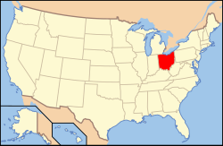
 Ohio's location in the U.S. | |
| Statistics | |
| Founded | April 1, 1811 |
|---|---|
| Seat | Coshocton |
| Largest City | Coshocton |
| Area - Total - Land - Water |
567 sq mi (1,469 km²) 564 sq mi (1,461 km²) 3.6 sq mi (9 km²), 0.6% |
| Population - (2020) - Density |
36,612 auto/sq mi (Expression error: Unrecognized word "auto"./km²) |
| Time zone | Eastern: UTC-5/-4 |
| Website: http://www.coshoctoncounty.net/ | |
| Named for: "union of waters" or "black bear crossing" in Delaware (Lenape) language | |
Coshocton County, Ohio Media
References
- ↑ "QuickFacts: Coshocton County, Ohio". United States Census Bureau. Retrieved January 18, 2024.
