Downieville, California
Downieville is a census-designated place (CDP) of California in the United States. It is the county seat of Sierra County.
 | |
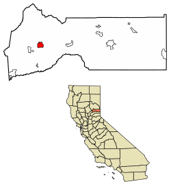
 Location of Downieville in Sierra County, California. | |
| Coordinates: 39°34′03″N 120°48′44″W / 39.56750°N 120.81222°WCoordinates: 39°34′03″N 120°48′44″W / 39.56750°N 120.81222°W | |
| Country | |
| State | |
| County | Sierra |
| Area | |
| • Total | 3.187 sq mi (8.252 km2) |
| • Land | 3.181 sq mi (8.238 km2) |
| • Water | 0.006 sq mi (0.014 km2) 0.17% |
| Elevation | 2,966 ft (904 m) |
| Population (2010) | |
| • Total | 282 |
| • Density | 88.48/sq mi (34.17/km2) |
| Time zone | UTC-8 (Pacific (PST)) |
| • Summer (DST) | UTC-7 (PDT) |
| ZIP codes | 95936 |
| FIPS code | 06-19794 |
| GNIS feature ID | 2583000 |
| U.S. Geological Survey Geographic Names Information System: Downieville, California | |