Far-Western Development Region, Nepal
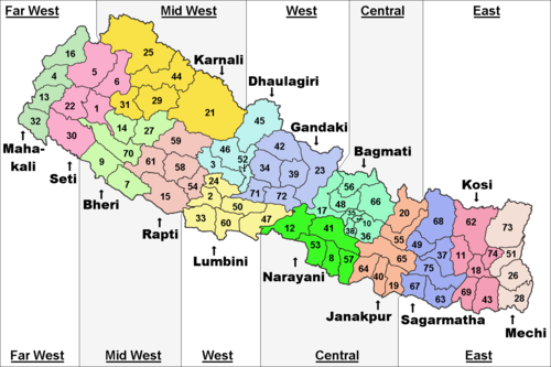
Far-Western Development Region (Nepali: सुदुर पश्चिमाञ्चल विकास क्षेत्र - Sudur Pashchimānchal Bikās Kshetra) was one of Nepal's five development regions. It was at the western end of the country. Its headquarters were at Dipayal Silgadhi.
|
Sudur Pashchimānchal Bikās Kshetra | |
|---|---|
 | |
| Coordinates: 29°16′N 80°56′E / 29.267°N 80.933°ECoordinates: 29°16′N 80°56′E / 29.267°N 80.933°E | |
| Country | |
| Region | Far-Western Development Region |
| Headquarters | Dipayal Silgadhi, Doti District, Seti Zone |
| Area | |
| • Total | 19,539 km2 (7,544 sq mi) |
| Population (2011 Census) | |
| • Total | 2,552,517 |
| • Density | 131/km2 (340/sq mi) |
| pop. note | |
| Time zone | UTC+5:45 (NPT) |
Geography
The Far-Western Development Region had the Mid-Western Development Region to the east, Uttar Pradesh (India) to the south, Uttarakhand (India) to the west and the Tibet Autonomous Region (People's Republic of China) to the north.
It was the smallest Development Region of Nepal with an area of 19,539 square kilometres (7,544 square miles). It had the lowest population, with 2,552,517 people in 2011.[1] Its population density was the second lowest of all the regions, with 130.6 persons/km2.
The highest mountain in the region was the Api Peak, with 7,132 metres (23,399 feet) high; it is in the Darchula district. Other high mountain is Saipal, 7,031 metres (23,068 feet) high, in the Bajhang district.
The most important rivers in the Far-Western Development Region were the Seti and the Mahakali (Sharda in India) rivers; both rivers are tributaries of the Karnali river.
Cities
The main city in the region was Mahendranagar, the eighth largest city of the country, at about 5 kilometres (3.1 miles) from the border of India.
Other cities of this region were Dipayal Silgadhi, Dhangadhi, Baitadi (Khalanga, Baitadi), etc.
Administrative subdivisions
The region had 2 zones with a total of 9 districts:
| Zone | Population[2] (2011) |
Area[3] (km²) |
Pop. density (inh/km²) |
Districts | |
|---|---|---|---|---|---|
| Number | Names | ||||
| Mahakali | 977,514 | 6,989 | 139.9 | 4 | Baitadi, Dadeldhura, Darchula, Kanchanpur |
| Seti | 1,575,003 | 12,550 | 125.5 | 5 | Achham, Bajhang, Bajura, Doti, Kailali |
| Total | 2,552,517 | 19,539 | 130.6 | 9 | |
Far-Western Development Region, Nepal Media
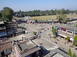
Madan chowk, Mahendranagar
References
- ↑ "National Population and Housing Census 2011" (PDF). Central Bureau of Statistics. Kathmandu, Nepal. November 2012. Archived from the original (pdf) on 7 January 2019. Retrieved 12 October 2013.
- ↑ "Nepal: Administrative Division". City Population. Retrieved 12 October 2013.
- ↑ "Regions of Nepal". Statoids. 2012-12-07. Retrieved 12 October 2013.

