File:AlbiaMines.png

Size of this preview: 800 × 510 pixels. Other resolutions: 320 × 204 pixels | 640 × 408 pixels | 1,024 × 653 pixels | 1,229 × 784 pixels.
Original file (1,229 × 784 pixels, file size: 197 KB, MIME type: image/png)
| This is a file from the Wikimedia Commons. The description on its description page there is shown below.
|
Summary
| Description |
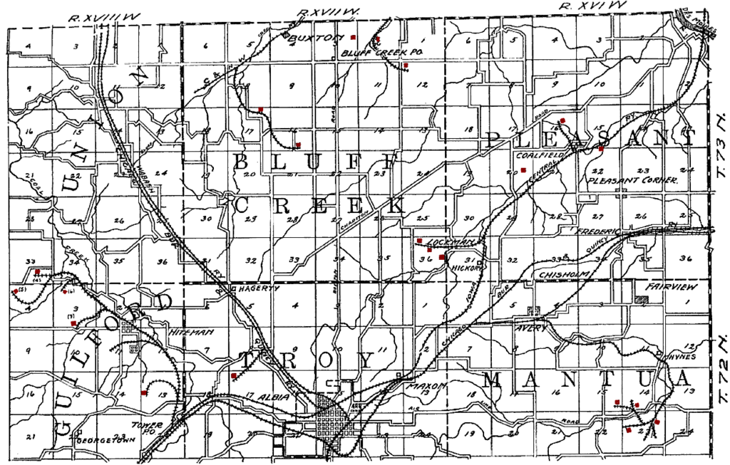
English: Original caption: "PLATE VIII. Map showing mines in northern Monroe county." The city is en:Albia, Iowa. Mines have been tinted red by the uploader. The railroads shown on the map are: CRI&P en:Chicago, Burlington and Quincy Railroad, CB&Q en:Wabash Railroad, CM&StP en:Chicago and North Western Railway, and en:Iowa Central Railway. Former coal mining camps include Hiteman, Buxton, Bluff Creek, Lockman, Coalfield and Hynes. |
| Date | |
| Source | The Coal Deposits of Iowa, Chapter I of Iowa Geological Survey Annual Report, 1908 |
| Author | Henry Hinds |
| Camera location | | View this and other nearby images on: OpenStreetMap |
|---|
Licensing
This media file is in the public domain in the United States. This applies to U.S. works where the copyright has expired, often because its first publication occurred prior to January 1, 1929, and if not then due to lack of notice or renewal. See this page for further explanation.
|
 | |
 |
This image might not be in the public domain outside of the United States; this especially applies in the countries and areas that do not apply the rule of the shorter term for US works, such as Canada, Mainland China (not Hong Kong or Macao), Germany, Mexico, and Switzerland. The creator and year of publication are essential information and must be provided. See Wikipedia:Public domain and Wikipedia:Copyrights for more details.
|
File history
Click on a date/time to view the file as it appeared at that time.
| Date/Time | Dimensions | User | Comment | |
|---|---|---|---|---|
| current | 12:53, 17 August 2009 | 1,229 × 784 (197 KB) | Douglas W. Jones | {{Information |Description={{en|1=Description={{en|1=Original caption: "PLATE VIII. Map showing mines in northern Monroe county." The city is en:Albia, Iowa. Mines have been tinted red by the uploader. The railroads shown on the map are: CRI&P [ |
File usage
The following page uses this file: