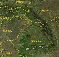
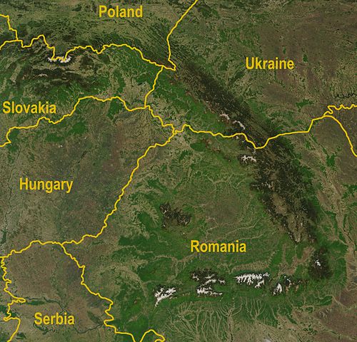
File:Carpathians-satellite.jpg

Size of this preview: 624 × 599 pixels. Other resolutions: 250 × 240 pixels | 500 × 480 pixels | 625 × 600 pixels | 800 × 768 pixels | 1,066 × 1,024 pixels | 2,625 × 2,521 pixels.
Original file (2,625 × 2,521 pixels, file size: 2.6 MB, MIME type: image/jpeg)
| This is a file from the Wikimedia Commons. The description on its description page there is shown below.
|
Summary
| Description | A satellite map of the Carpathians |
| Date | |
| Source |
http://visibleearth.nasa.gov/view_rec.php?id=5348
|
| Author | Jeff Schmaltz, MODIS Rapid Response Team, NASA/GSFC |
| Other versions | Image:Karpaty zdjęcie satelitarne.jpg |
Licensing
| This file is in the public domain in the United States because it was solely created by NASA. NASA copyright policy states that "NASA material is not protected by copyright unless noted". (See Template:PD-USGov, NASA copyright policy page or JPL Image Use Policy.) | ||
 |
Warnings:
|
File history
Click on a date/time to view the file as it appeared at that time.
| Date/Time | Dimensions | User | Comment | |
|---|---|---|---|---|
| current | 05:36, 30 August 2009 | 2,625 × 2,521 (2.6 MB) | Qorilla | Better resolution, yellow country names |
File usage
The following page uses this file: