File:Devils Tower aerial.jpg
Size of this preview: 800 × 423 pixels. Other resolutions: 320 × 169 pixels | 640 × 338 pixels | 1,024 × 542 pixels | 1,857 × 982 pixels.
Original file (1,857 × 982 pixels, file size: 2.16 MB, MIME type: image/jpeg)
| This is a file from the Wikimedia Commons. The description on its description page there is shown below.
|
Summary
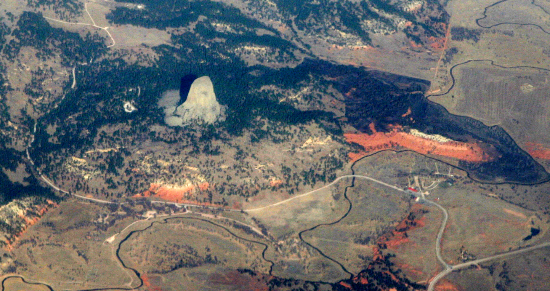
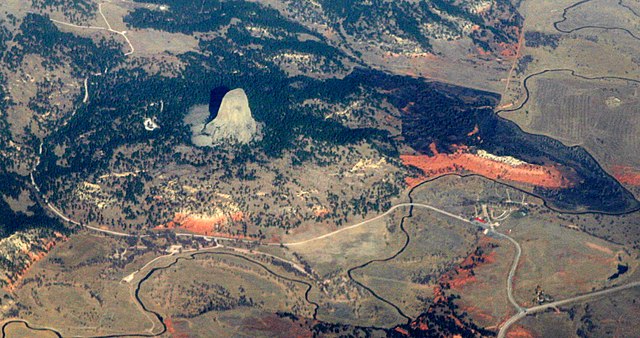
| Description | Devils Tower, a national monument in northeastern Wyoming, above the Belle Fourche River. Familiar to most folks as the setting for Close Encounters of the Third Kind, it was known by the Sioux as "Mato Tipila, which means “Bear Lodge”. In fact it is the neck of a long-extinct volcano. The circular shape of the land around it suggests the shape of the volcano itself. While Devils Tower is Tertriary in age (40-some million years old), the rock through which it intruded is a good bit older. The red rock is the Permian-Triassic Spearfish Formation, about a quarter-billion years old. Above it the white layer is of the more recent (Jurassic) Gypsum Spring Formation, which interests me mostly because, like so many other formations in Wyoming, it was named by J. David Love, the great Rocky Mountain Geologist who was the primary human subject of John McPhee's books Rising from the Plains, and Annals of the Former World. |
| Date | |
| Source |
|
| Author | Doc Searls from Santa Barbara, USA |
| Camera location | | View this and other nearby images on: OpenStreetMap |
|---|
Licensing
This file is licensed under the Creative Commons Attribution 2.0 Generic license.
- You are free:
- to share – to copy, distribute and transmit the work
- to remix – to adapt the work
- Under the following conditions:
- attribution – You must give appropriate credit, provide a link to the license, and indicate if changes were made. You may do so in any reasonable manner, but not in any way that suggests the licensor endorses you or your use.
| This image, originally posted to Flickr, was reviewed on December 1, 2010 by the administrator or reviewer File Upload Bot (Magnus Manske), who confirmed that it was available on Flickr under the stated license on that date. |
File history
Click on a date/time to view the file as it appeared at that time.
| Date/Time | Dimensions | User | Comment | |
|---|---|---|---|---|
| current | 18:46, 30 November 2010 | 1,857 × 982 (2.16 MB) | File Upload Bot (Magnus Manske) | {{Information |Description=[http://en.wikipedia.org/wiki/Devils_Tower_National_Monument Devils Tower], a [http://www.nps.gov/deto/ national monument] in northeastern Wyoming, above the [http://en.wikipedia.org/wiki/Belle_Fourche_River Belle Fourche River] |
File usage
The following page uses this file: