File:Districts and tehsils of Pakistan.png

Size of this preview: 635 × 599 pixels. Other resolutions: 254 × 240 pixels | 509 × 480 pixels | 636 × 600 pixels | 814 × 768 pixels | 1,085 × 1,024 pixels | 1,496 × 1,412 pixels.
Original file (1,496 × 1,412 pixels, file size: 76 KB, MIME type: image/png)
| This is a file from the Wikimedia Commons. The description on its description page there is shown below.
|

|
File:Map of Pakistan (2017).svg is a vector version of this file. It should be used in place of this PNG file when not inferior.
File:Districts and tehsils of Pakistan.png → File:Map of Pakistan (2017).svg
For more information, see Help:SVG. |
.svg) |
|
|
File:Map of Pakistan (2018).svg is a vector version of this file. It should be used in place of this PNG file when not inferior.
File:Districts and tehsils of Pakistan.png → File:Map of Pakistan (2018).svg
For more information, see Help:SVG. |
.svg) |
Summary
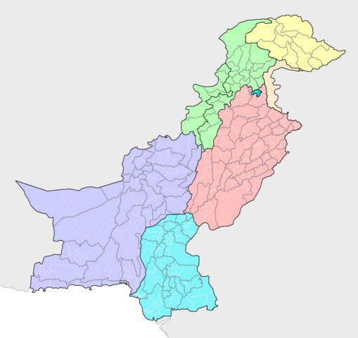
| Description | Map of the districts of Pakistan, with their constituent tehsils (thin white borders). Map includes the disputed areas. Created by Rarelibra 20:47, 31 October 2007 (UTC) for public domain use, using MapInfo Professional v8.5 and various mapping resources. |
| Date | 31 October 2007 (original upload date) |
| Source | Own work |
| Author | Rarelibra |
Licensing
| I, the copyright holder of this work, release this work into the public domain. This applies worldwide. In some countries this may not be legally possible; if so: I grant anyone the right to use this work for any purpose, without any conditions, unless such conditions are required by law. |
File history
Click on a date/time to view the file as it appeared at that time.
| Date/Time | Dimensions | User | Comment | |
|---|---|---|---|---|
| current | 14:16, 9 May 2019 | 1,496 × 1,412 (76 KB) | Milenioscuro | recolored, cut out leftover areas |
File usage
The following page uses this file: