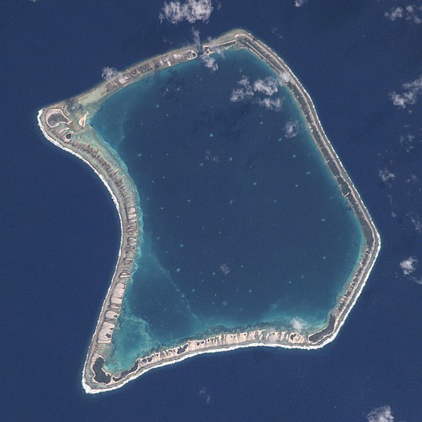
File:Fangataufa.JPG

Original file(2,000 × 2,000 pixels, file size: 402 KB, MIME type: image/jpeg)

Commons-logo.svg This is a file from the Wikimedia Commons. The description on its description page there is shown below.
Commons is a freely licensed media file repository. You can help.

Summary

Description
English: NASA Astronaut Image of Fangataufa Atoll (Tuamotu Archipelago, French Polynesia) in the Pacific Ocean
Русский: Космический снимок НАСА атолла Фангатауфа (архипелаг Туамоту, Французская Полинезия) в Тихом океане
Date
Source http://nix.larc.nasa.gov/info;jsessionid=1ci2vn53647eg?id=ISS002-E-7354&orgid=3
Author NASA Johnson Space Center - Earth Sciences and Image Analysis
Camera location22° 14′ 06.95″ S, 138° 44′ 33.59″ W Kartographer map based on OpenStreetMap.View this and other nearby images on: OpenStreetMapinfo
This image or video was catalogued by Johnson Space Center of the United States National Aeronautics and Space Administration (NASA) under Photo ID: ISS002-E-7354.

This tag does not indicate the copyright status of the attached work. A normal copyright tag is still required. See Commons:Licensing.
Other languages:

Licensing

Public domain
This file is in the public domain in the United States because it was created by the Image Science & Analysis Laboratory, of the NASA Johnson Space Center. NASA copyright policy states that "NASA material is not protected by copyright unless noted". (NASA media use guidelines or Conditions of Use of Astronaut Photographs). Photo source: ISS002-E-7354.

العربيَّة | Deutsch | English | español | français | italiano | kurdî | македонски | മലയാളം | português | sicilianu | +/−

VI seal

This image has been assessed under the valued image criteria and is considered the most valued image on Commons within the scope: Fangataufa atoll, French Polynesia - satellite view. You can see its nomination here.

Captions

Add a one-line explanation of what this file represents

Items portrayed in this file

depicts

15 June 2001

image/jpeg

4e25b939d853766718705dd372cdd3daba6215a8

411,501 byte

2,000 pixel

2,000 pixel

22°14'6.947"S, 138°44'33.587"W

File history

Click on a date/time to view the file as it appeared at that time.

Date/TimeDimensionsUserComment
current11:06, 29 June 20172,000 × 2,000 (402 KB)Szczureqfull resolution

The following page uses this file:

Metadata