File:Hietzing - Schönbrunn, römische Ruine.JPG
Size of this preview: 800 × 533 pixels. Other resolutions: 320 × 213 pixels | 640 × 427 pixels | 1,024 × 683 pixels | 1,280 × 853 pixels | 4,547 × 3,031 pixels.
Original file (4,547 × 3,031 pixels, file size: 11.89 MB, MIME type: image/jpeg)
| This is a file from the Wikimedia Commons. The description on its description page there is shown below.
|
Summary
| Description |
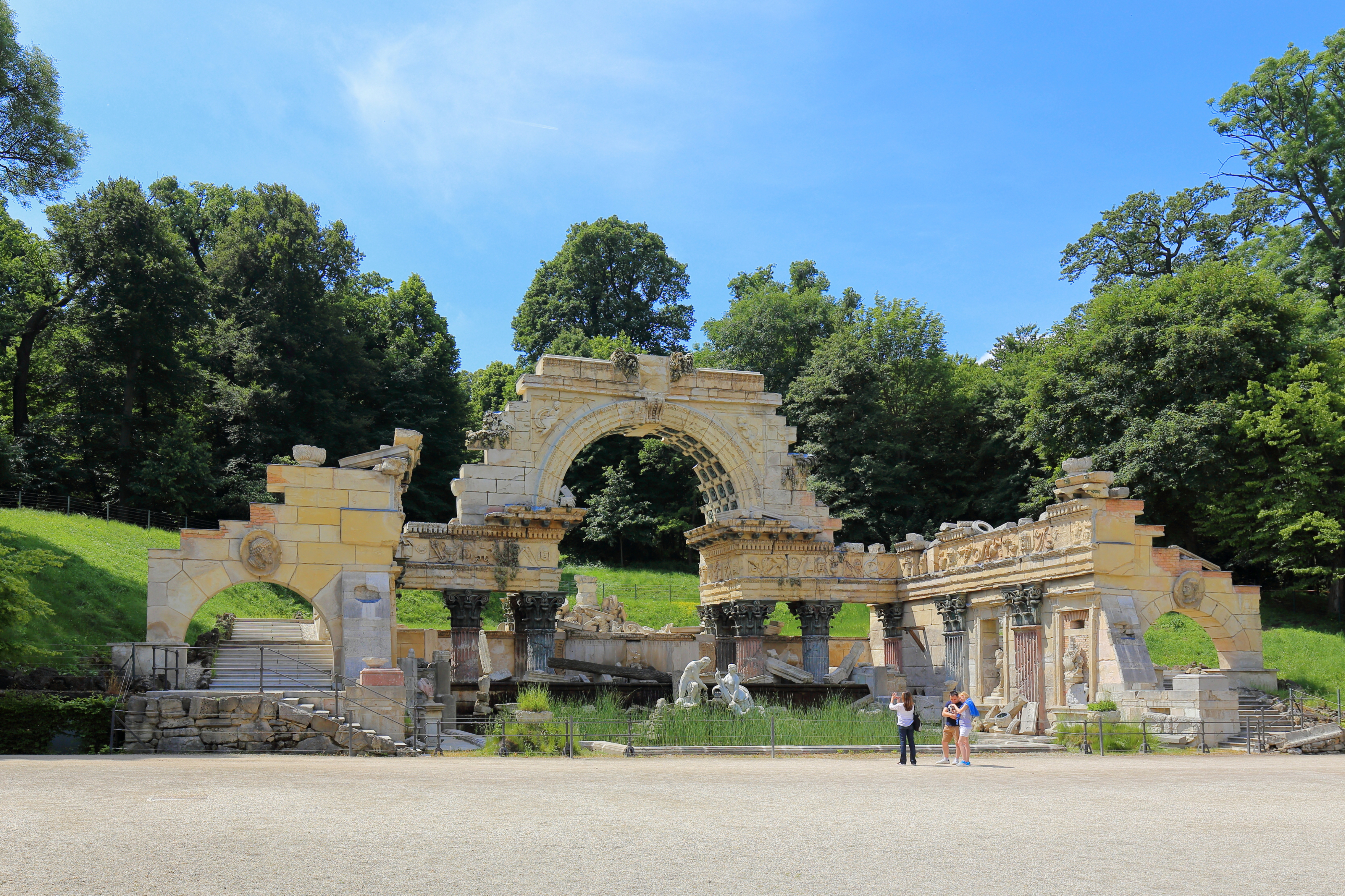
Deutsch: Die Follyanlage „römische Ruine“ im Schönbrunner Schloßpark im 13. Wiener Gemeindebezirk Hietzing.
Das ursprünglich als „Ruine von Karthago“ bezeichnete Ensemble wurde linksseitig am Fuße des bewaldeten Schönbrunner Berges nach Plänen von Johann Ferdinand Hetzendorf von Hohenberg im Jahre 1778 errichtet. Es ist ein vollständigen Neubau nach dem römischen Vorbild des antiken Vespasian und Titus-Tempels, dessen Überreste durch den um 1756 entstandenen Stich von Giovanni Battista Piranesi überliefert waren. Im Bassin vor der Ruine befindet sich eine Figurengruppe der Flussgötter Donau und Enns, die Wilhelm Beyer schuf. Die Steindekorationen wurden von dem Vorgenannten und den Bildhauern Benedikt Henrici sowie Franz Zächerle angefertigt.
|
|||
| Date | ||||
| Source | Own work | |||
| Author | C.Stadler/Bwag | |||
| Permission (Reusing this file) |
Deutsch: Hallo, du darfst mein Foto kostenlos nutzen, aber nenne mich bitte als Fotograf, beispielsweise „Foto: C.Stadler/Bwag“ oder © C.Stadler/Bwag; CC-BY-SA-4.0. Auf mehr Angaben bestehe ich nicht - im Gegensatz zu manch anderen, die die Vorgaben der unten angeführten Lizenzierung auf Punkt und Beistrich einfordern. English: Feel free to use my photos, but please mention me as the author like © C.Stadler/Bwag or © C.Stadler/Bwag; CC-BY-SA-4.0 (that's good enough) and if you want send me a message: bwag@gmx.net. |

| Camera location | | View this and other nearby images on: OpenStreetMap |
|---|
Licensing
I, the copyright holder of this work, hereby publish it under the following license:
This file is licensed under the Creative Commons Attribution-Share Alike 4.0 International license.
- You are free:
- to share – to copy, distribute and transmit the work
- to remix – to adapt the work
- Under the following conditions:
- attribution – You must give appropriate credit, provide a link to the license, and indicate if changes were made. You may do so in any reasonable manner, but not in any way that suggests the licensor endorses you or your use.
- share alike – If you remix, transform, or build upon the material, you must distribute your contributions under the same or compatible license as the original.
File history
Click on a date/time to view the file as it appeared at that time.
| Date/Time | Dimensions | User | Comment | |
|---|---|---|---|---|
| current | 12:39, 7 June 2016 | 4,547 × 3,031 (11.89 MB) | Bwag | {{Information |Description= {{de|1=Die Follyanlage „römische Runine“ im Schönbrunner Schloßpark im 13. Wiener Gemeindebezirk Hietzing.<br/>Das urs... |
File usage
The following page uses this file: