File:Historic American Buildings Survey Frederick D. Nichols, Photographer August 1936 VIEW OF FRONT AND SIDE - Santa Nina de Atoche, Tijeras Plaza, Tijeras, Las Animas County, CO HABS COLO,36-TIJER,1-1.tif

Size of this preview of this TIF file: 800 × 509 pixels. Other resolutions: 320 × 203 pixels | 640 × 407 pixels | 1,024 × 651 pixels | 1,280 × 814 pixels | 5,000 × 3,179 pixels.
Original file (5,000 × 3,179 pixels, file size: 15.16 MB, MIME type: image/tiff)
| This is a file from the Wikimedia Commons. The description on its description page there is shown below.
|
Summary
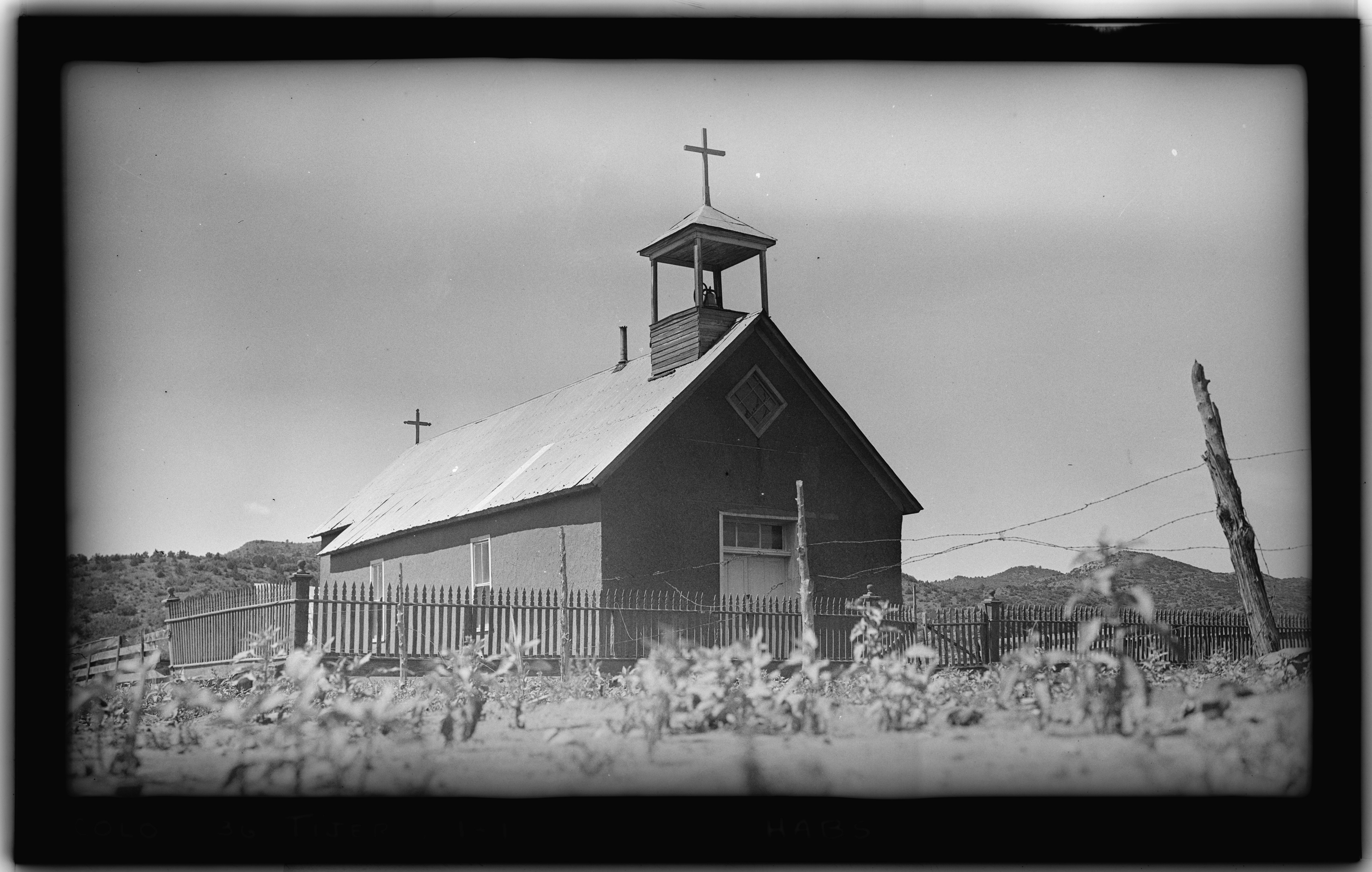
| Historic American Buildings Survey Frederick D. Nichols, Photographer August 1936 VIEW OF FRONT AND SIDE - Santa Nina de Atoche, Tijeras Plaza, Tijeras, Las Animas County, CO | ||||
|---|---|---|---|---|
| Title |
Historic American Buildings Survey Frederick D. Nichols, Photographer August 1936 VIEW OF FRONT AND SIDE - Santa Nina de Atoche, Tijeras Plaza, Tijeras, Las Animas County, CO |
|||
| Depicted place | Colorado; Las Animas County; Tijeras | |||
| Dimensions | 4 x 5 in. | |||
| Current location |
Library of Congress Prints and Photographs Division Washington, D.C. 20540 USA http://hdl.loc.gov/loc.pnp/pp.print |
|||
| Accession number |
HABS COLO,36-TIJER,1-1 |
|||
| Credit line |
|
|||
| Notes | A 2023 view that tries to duuplicate this picture is here. | |||
| Source | https://www.loc.gov/pictures/item/co0025.photos.021602p | |||
| Permission (Reusing this file) |
|
|||

.JPG)
| Camera location | | View this and other nearby images on: OpenStreetMap |
|---|
File history
Click on a date/time to view the file as it appeared at that time.
| Date/Time | Dimensions | User | Comment | |
|---|---|---|---|---|
| current | 22:27, 7 July 2014 | 5,000 × 3,179 (15.16 MB) | Fæ | GWToolset: Creating mediafile for Fæ. HABS 05 July 2014 (501:600) |
File usage
The following page uses this file: