File:Hurricane Katrina LA landfall radar.gif
No higher resolution available.
Hurricane_Katrina_LA_landfall_radar.gif (772 × 455 pixels, file size: 6.05 MB, MIME type: image/gif, looped, 38 frames, 12 s)
Note: Due to technical limitations, thumbnails of high resolution GIF images such as this one will not be animated.
| This is a file from the Wikimedia Commons. The description on its description page there is shown below.
|
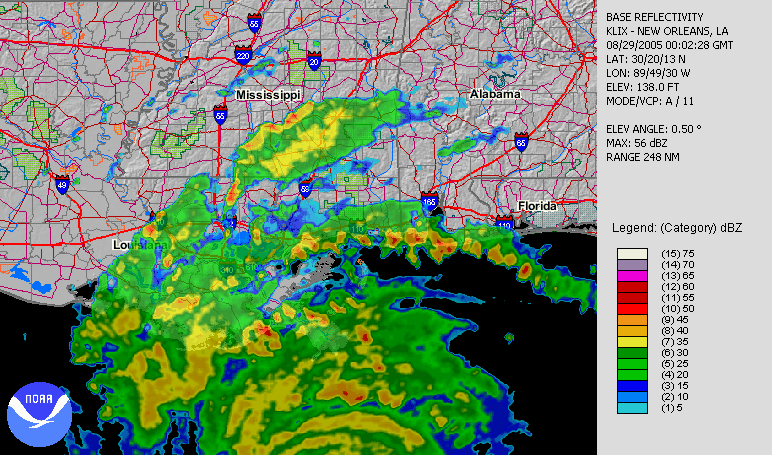
| Description | Hurricane Katrina making its second landfall in Louisiana, as seen by NWS New Orleans radar. | |||
| Date | ||||
| Source | Animation orginally located on the NCDC August 2005 (direct link). | |||
| Author | Radar data from NWS New Orleans and processed by the National Climatic Data Center. | |||
| Permission (Reusing this file) |
|
File history
Click on a date/time to view the file as it appeared at that time.
| Date/Time | Dimensions | User | Comment | |
|---|---|---|---|---|
| current | 12:35, 29 August 2006 | 772 × 455 (6.05 MB) | Nilfanion | {{Information |Description=Hurricane Katrina making its second landfall in Louisiana, as seen by NWS New Orleans radar. |Source=Animation orginally located on the [http://www.ncdc.noaa.gov/oa/climate/research/2005/aug/hazards.html NCDC August 2005] ([http |
File usage
The following 3 pages use this file: