File:India Kerala Thiruvananthapuram district.svg

Size of this PNG preview of this SVG file: 411 × 599 pixels. Other resolutions: 164 × 240 pixels | 329 × 480 pixels | 411 × 600 pixels | 527 × 768 pixels | 702 × 1,024 pixels | 874 × 1,274 pixels.
Original file (SVG file, nominally 874 × 1,274 pixels, file size: 539 KB)
| This is a file from the Wikimedia Commons. The description on its description page there is shown below.
|
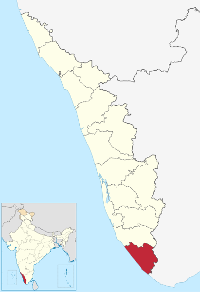
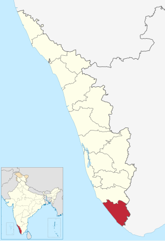
| Description | Location of Thiruvananthapuram district in Kerala |
| Date | (UTC) |
| Source | |
| Author |
|
I, the copyright holder of this work, hereby publish it under the following license:
This file is licensed under the Creative Commons Attribution-Share Alike 3.0 Unported license.
- You are free:
- to share – to copy, distribute and transmit the work
- to remix – to adapt the work
- Under the following conditions:
- attribution – You must give appropriate credit, provide a link to the license, and indicate if changes were made. You may do so in any reasonable manner, but not in any way that suggests the licensor endorses you or your use.
- share alike – If you remix, transform, or build upon the material, you must distribute your contributions under the same or compatible license as the original.
Original upload log
This image is a derivative work of the following images:
- File:India_Kerala_location_map.svg licensed with Cc-by-sa-3.0
- 2011-03-11T09:30:07Z NordNordWest 827x1205 (135528 Bytes) =={{int:filedesc}}== {{Information |Description= {{de|Positionskarte von [[:de:Kerala|Kerala]], [[:de:Indien|Indien]]}} Quadratische Plattkarte, N-S-Streckung 102 %. Geographische Begrenzung der Karte: * N: 13.0° N * S: 8.0�
Uploaded with derivativeFX
File history
Click on a date/time to view the file as it appeared at that time.
| Date/Time | Dimensions | User | Comment | |
|---|---|---|---|---|
| current | 09:54, 10 June 2023 | 874 × 1,274 (539 KB) | C1MM | updated bounds |
File usage
The following page uses this file: