File:Iron Curtain map.svg

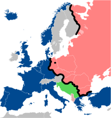
Size of this PNG preview of this SVG file: 560 × 599 pixels. Other resolutions: 224 × 240 pixels | 449 × 480 pixels | 561 × 600 pixels | 718 × 768 pixels | 957 × 1,024 pixels | 645 × 690 pixels.
Original file (SVG file, nominally 645 × 690 pixels, file size: 322 KB)
| This is a file from the Wikimedia Commons. The description on its description page there is shown below.
|
Summary
| Description |
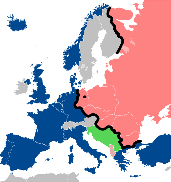
Lëtzebuergesch: Kaart vum Westen an dem Ostblock an Europa während dem Kale Krich.
"Eise Rido"
Neutral Länner
|
||
| Date | |||
| Source |
Travail personnel (own work). Sources:
|
||
| Author | Sémhur | ||
| Other versions |
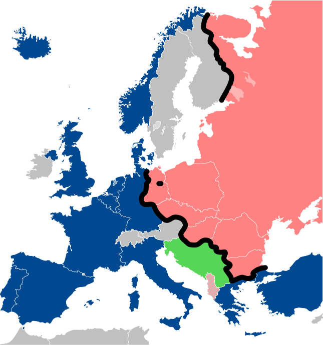
File:Iron Curtain map alternative.svg (Same, but with Yugoslavia on the Eastern side of the Iron Curtain.) | ||
| Attribution (required by the license) | © Sémhur / Wikimedia Commons / | ||
| SVG | W3C-validity not checked.
|
||
| Graphic Lab |

| Camera location | | View this and other nearby images on: OpenStreetMap |
|---|
Licensing
I, the copyright holder of this work, hereby publish it under the following licenses:
| Copyleft: This work of art is free; you can redistribute it and/or modify it according to terms of the Free Art License. You will find a specimen of this license on the Copyleft Attitude site as well as on other sites. |
This file is licensed under the Creative Commons Attribution-Share Alike 4.0 International, 3.0 Unported, 2.5 Generic, 2.0 Generic and 1.0 Generic license.
- You are free:
- to share – to copy, distribute and transmit the work
- to remix – to adapt the work
- Under the following conditions:
- attribution – You must give appropriate credit, provide a link to the license, and indicate if changes were made. You may do so in any reasonable manner, but not in any way that suggests the licensor endorses you or your use.
- share alike – If you remix, transform, or build upon the material, you must distribute your contributions under the same or compatible license as the original.
You may select the license of your choice.
File history
Click on a date/time to view the file as it appeared at that time.
| Date/Time | Dimensions | User | Comment | |
|---|---|---|---|---|
| current | 06:26, 15 December 2022 | 645 × 690 (322 KB) | PhotographyEdits | Extend the Iron Curtain eastwards of Yugoslavia. Even though Yugoslavia was not really considered part of the West, the currenet map gives the false impression that there was a huge gap in the Iron Curtain, which wasn't the case. |
File usage
The following 2 pages use this file: