File:Isparta Mimar Sinan (Firdevs Paşa) Cami 2437.jpg

Original file (4,928 × 3,280 pixels, file size: 12.47 MB, MIME type: image/jpeg)
| This is a file from the Wikimedia Commons. The description on its description page there is shown below.
|
_Cami_2437.jpg)
Summary
| Description |
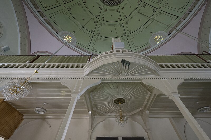
English: Looking up to the balcony above the entrance.
From the local website, put in English: "The mosque has a square plan. It has a single minaret with a single balcony in the northwest direction. The base of the minaret balcony has stalactites and its balusters are decorated with lattice workmanship. There are five small domes in the narthex of the mosque, which has a large dome on the main space. The upper windows of the mosque are decorated with coloured glass workmanship. While all of the upper windows in the south direction have stained glass, it is possible to see this work on the edges of the windows in other directions. The mihrab basement is decorated with seven rows of stalactites. It is known that Mimar Sinan, the Murat Periods, prepared the plans of many mosques in the Ottoman Empire. Several works (Tezkiretü'l Bünyan, Tezkiretü'-l Ebniye and Tufetü'l- Mimarin) state that the Firdevs Pasha Mosque was planned and built in 1561 by Mimar Sinan, who served as the chief architect during the reigns of Suleiman the Magnificent, Selim II Selim and Murat III. In addition, Evliya Çelebi's Travelogue contains the statement "Koca Sinan built this mosque". The mosque, which does not have an inscription, is mentioned in the endowment of Isparta’s Governor Firdevs Bey in 1565 AD and it is understood that Firdevs Bey financed the mosque. It is possible to suggest that the mosque was planned and built by Mimar Sinan, considering both the information in his foundation and the fact that the mosque was built in 1561. |
| Date | |
| Source | Own work |
| Author | Dosseman |
| Camera location | | View this and other nearby images on: OpenStreetMap |
|---|
_Cami_2437.jpg¶ms=037.764688_N_0030.554602_E_globe:Earth_type:camera__&language=en)
Licensing
- You are free:
- to share – to copy, distribute and transmit the work
- to remix – to adapt the work
- Under the following conditions:
- attribution – You must give appropriate credit, provide a link to the license, and indicate if changes were made. You may do so in any reasonable manner, but not in any way that suggests the licensor endorses you or your use.
- share alike – If you remix, transform, or build upon the material, you must distribute your contributions under the same or compatible license as the original.
File history
Click on a date/time to view the file as it appeared at that time.
| Date/Time | Dimensions | User | Comment | |
|---|---|---|---|---|
| current | 04:47, 14 March 2023 | 4,928 × 3,280 (12.47 MB) | Dosseman | Full size |
File usage
The following page uses this file:
_Cami_2437.jpg)