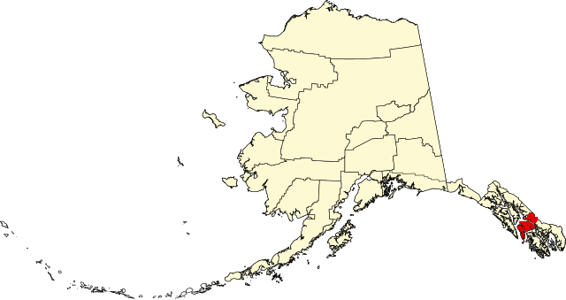
File:Map of Alaska highlighting Petersburg Census Area.svg

Size of this PNG preview of this SVG file: 800 × 423 pixels. Other resolutions: 320 × 169 pixels | 640 × 338 pixels | 1,024 × 541 pixels | 1,280 × 677 pixels | 1,470 × 777 pixels.
Original file (SVG file, nominally 1,470 × 777 pixels, file size: 428 KB)
| This is a file from the Wikimedia Commons. The description on its description page there is shown below.
|
| Description | |||
| Date | |||
| Source | Own work | ||
| Author | Dtbohrer | ||
| Permission (Reusing this file) |
|
||
| Other versions |
 |
||
| SVG development |
File history
Click on a date/time to view the file as it appeared at that time.
| Date/Time | Dimensions | User | Comment | |
|---|---|---|---|---|
| current | 15:17, 25 January 2009 | 1,470 × 777 (428 KB) | Niagara | == Summary == {{Information |Description={{en|1=Map of Alaska highlighting the Petersburg Census Area}} |Source=self made |Author=Dtbohrer |Date=January 25, 2009 |Permission= |other_versi |
File usage
The following page uses this file: