File:Navigation on St Clair River.jpg

Size of this preview: 800 × 561 pixels. Other resolutions: 320 × 224 pixels | 640 × 448 pixels | 1,024 × 717 pixels | 1,280 × 897 pixels | 1,500 × 1,051 pixels.
Original file (1,500 × 1,051 pixels, file size: 641 KB, MIME type: image/jpeg)
| This is a file from the Wikimedia Commons. The description on its description page there is shown below.
|
| Description |
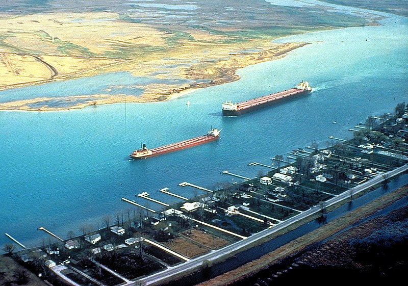
English: Great Lakes freighters navigating on the lower St. Clair River between Michigan, USA and Ontario, Canada. The view is from the American side looking across to Canada. The Walpole Island Indian Reserve is directly across on the Canadian side. |
|||
| Date | not specified or unknown | |||
| Source |
U.S. Army Corps of Engineers Digital Visual Library Image page Image description page Digital Visual Library home page |
|||
| Author | U.S. Army Corps of Engineers, photographer not specified or unknown | |||
| Permission (Reusing this file) |
|
|||
| Location | St. Clair River, east of Detroit, Michigan, USA |
| Camera location | | View this and other nearby images on: OpenStreetMap |
|---|
File history
Click on a date/time to view the file as it appeared at that time.
| Date/Time | Dimensions | User | Comment | |
|---|---|---|---|---|
| current | 20:06, 28 March 2007 | 1,500 × 1,051 (641 KB) | DanMS | {{Information | Description = {{en|Great Lakes freighters navigating on the lower St. Clair River between Michigan, USA and Ontario, Canada. The view is from the American side looking across to Canada. The Walpole Island Indian Reserve is directly acro |
File usage
The following page uses this file: