File:Plymouth Landsat.jpg

Size of this preview: 800 × 600 pixels. Other resolutions: 320 × 240 pixels | 640 × 480 pixels | 1,023 × 767 pixels.
Original file (1,023 × 767 pixels, file size: 430 KB, MIME type: image/jpeg)
| This is a file from the Wikimedia Commons. The description on its description page there is shown below.
|
Summary
| Description |
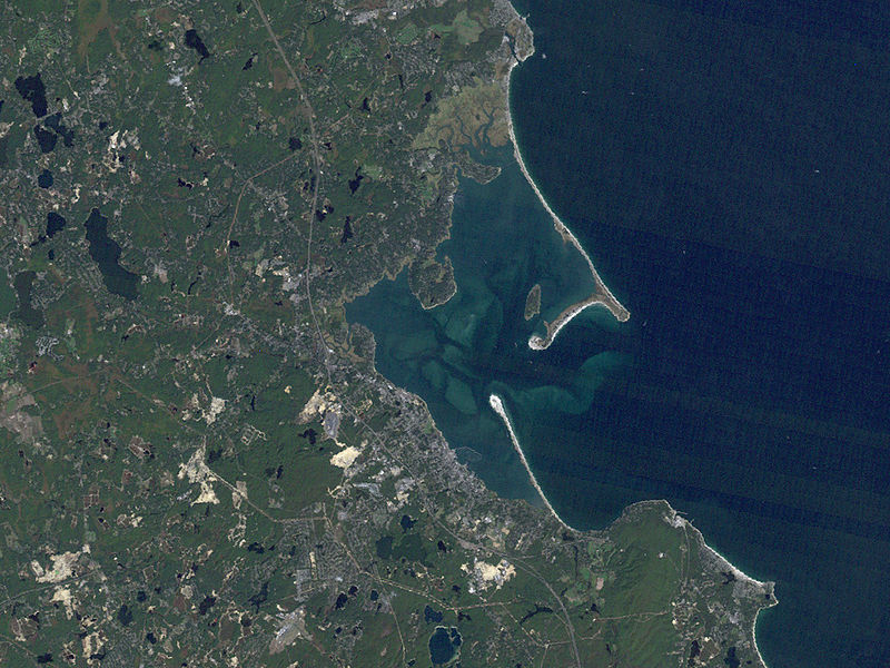
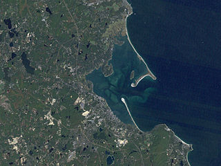
English: Overview of Plymouth Bay and Plymouth Harbor in Plymouth, Massachusetts. The western shore of Cape Cod Bay is visible, and the towns of Plymouth, Duxbury and Kingston can be seen. Plymouth Beach and Saquish Neck are visible jutting out into the bay. |
| Source | |
| Author |
Plymouth, Massachusetts LANDSAT
Licensing
| This file is in the public domain in the United States because it was solely created by NASA. NASA copyright policy states that "NASA material is not protected by copyright unless noted". (See Template:PD-USGov, NASA copyright policy page or JPL Image Use Policy.) | ||
 |
Warnings:
|
Original upload log
Transferred from en.wikipedia to Commons using For the Common Good.
The original description page was here. All following user names refer to en.wikipedia.
| Date/Time | Dimensions | User | Comment |
|---|---|---|---|
| 01:33, 10 August 2007 | 1,023 × 767 (439,939 bytes) | w:en:Raime (talk | contribs) | (==Summary== Overview of [[Plymouth Bay]] and [[Plymouth Harbor]] in [[Plymouth, Massachusetts]]. The western shore of [[Cape Cod Bay]] is visible, and the towns of Plymouth, [[Duxbury, Massachusetts|Duxbury]] and [[Kingston, Massachusetts|Kingston]] can b) |
File history
Click on a date/time to view the file as it appeared at that time.
| Date/Time | Dimensions | User | Comment | |
|---|---|---|---|---|
| current | 02:48, 22 June 2012 | 1,023 × 767 (430 KB) | Hydriz | Transferred from en.wikipedia: see original upload log above |
File usage
The following page uses this file: