File:Political map of Canada.svg

Size of this PNG preview of this SVG file: 736 × 599 pixels. Other resolutions: 295 × 240 pixels | 590 × 480 pixels | 737 × 600 pixels | 943 × 768 pixels | 1,258 × 1,024 pixels | 1,130 × 920 pixels.
Original file (SVG file, nominally 1,130 × 920 pixels, file size: 272 KB)
| This is a file from the Wikimedia Commons. The description on its description page there is shown below.
|
Summary
| Description |
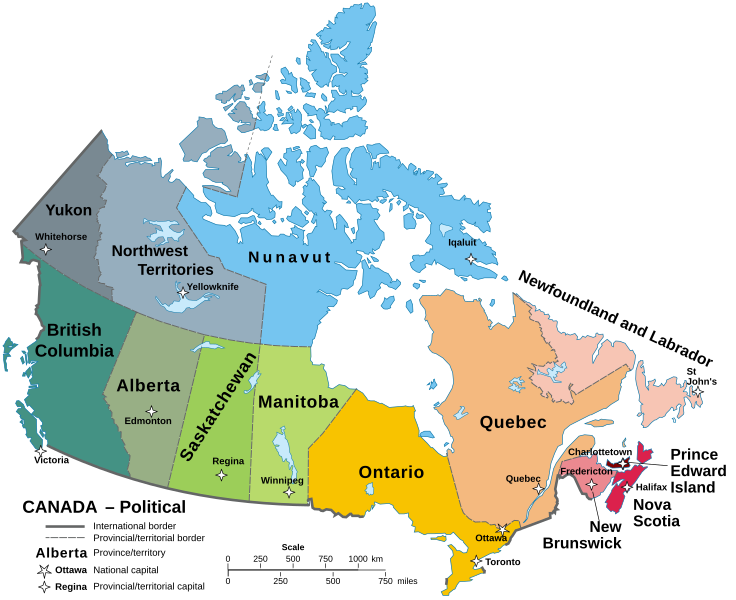
English: A map of Canada in its Provinces and territories Català: Mapa de les províncies i territoris del Canadà. |
||
| Date | |||
| Source | Localisation Manitoba.svg | ||
| Author | Hogweard | ||
| Permission (Reusing this file) |
|
||
| Other versions |
Carte Politique du Canada.svg File:Political map of Canada.svg has 1 translations.
|

File history
Click on a date/time to view the file as it appeared at that time.
| Date/Time | Dimensions | User | Comment | |
|---|---|---|---|---|
| current | 04:58, 22 September 2023 | 1,130 × 920 (272 KB) | Lalpino | File uploaded using svgtranslate tool (https://svgtranslate.toolforge.org/). Added translation for ca. |
File usage
The following 2 pages use this file: