File:Sri Ranganayaka Swamy temple Srirangapur, Wanaparthy Telangana, India - 7.jpg

Size of this preview: 800 × 600 pixels. Other resolutions: 320 × 240 pixels | 640 × 480 pixels | 1,024 × 768 pixels | 1,280 × 960 pixels | 4,032 × 3,024 pixels.
Original file (4,032 × 3,024 pixels, file size: 5.8 MB, MIME type: image/jpeg)
| This is a file from the Wikimedia Commons. The description on its description page there is shown below.
|
Summary
| Description |
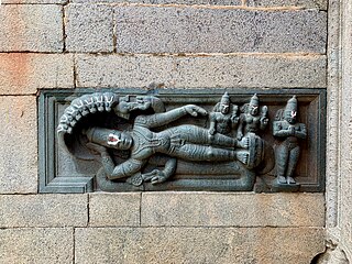
English: Srirangapur, also called Srirangapuram, is a village in Wanaparthy (Wanaparthi) district. It is located on the banks of Ratna Pushkarni – a historic, major man made water reservoir and a irrigation infrastructure project of the Vijayanagara rulers. Srirangapur is about 175 kilometers south of Hyderabad (NH 44), and about 65 kilometers north of Kurnool, Andhra Pradesh.
|
| Date | |
| Source | Own work |
| Author | Ms Sarah Welch |
| Camera location | | View this and other nearby images on: OpenStreetMap |
|---|
Licensing
I, the copyright holder of this work, hereby publish it under the following license:
| This file is made available under the Creative Commons CC0 1.0 Universal Public Domain Dedication. | |
| The person who associated a work with this deed has dedicated the work to the public domain by waiving all of their rights to the work worldwide under copyright law, including all related and neighboring rights, to the extent allowed by law. You can copy, modify, distribute and perform the work, even for commercial purposes, all without asking permission.
|
File history
Click on a date/time to view the file as it appeared at that time.
| Date/Time | Dimensions | User | Comment | |
|---|---|---|---|---|
| current | 02:03, 6 April 2021 | 4,032 × 3,024 (5.8 MB) | Ms Sarah Welch | Uploaded own work with UploadWizard |
File usage
The following page uses this file: