File:Virginia Frederick Stephens City.png

Size of this preview: 743 × 600 pixels. Other resolutions: 297 × 240 pixels | 595 × 480 pixels | 820 × 662 pixels.
Original file (820 × 662 pixels, file size: 133 KB, MIME type: image/png)
| This is a file from the Wikimedia Commons. The description on its description page there is shown below.
|
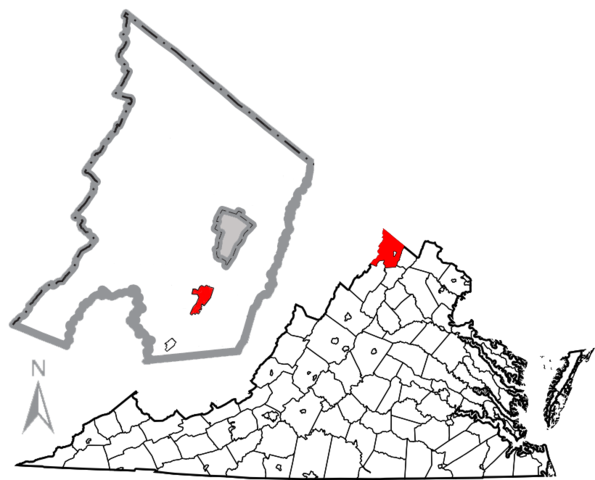
| Description | Combination map of Virginia showing Frederick County, originally created by David Benbennick with a map of Frederick County and the town of Stephens City highlighted in red, created by User:JonRidinger. The gray are in the middle of the Frederick County map is the independent city of Winchester. |
| Date | (UTC) |
| Source | |
| Author |
|
| This is a retouched picture, which means that it has been digitally altered from its original version. Modifications: Combined maps, moved compass, removed distance scale. The original can be viewed here: Map of Virginia highlighting Frederick County.svg:
|
This file is licensed under the Creative Commons Attribution 3.0 Unported license.
- You are free:
- to share – to copy, distribute and transmit the work
- to remix – to adapt the work
- Under the following conditions:
- attribution – You must give appropriate credit, provide a link to the license, and indicate if changes were made. You may do so in any reasonable manner, but not in any way that suggests the licensor endorses you or your use.
Original upload log
This image is a derivative work of the following images:
- File:Frederick_Stephens_City.png licensed with Cc-by-sa-2.5, Cc-by-sa-3.0-migrated, GFDL, PD-USGov-DOC-Census
- 2010-05-03T03:36:57Z JonRidinger 424x555 (45971 Bytes) Updated boundaries of Stephens City and Middletown using 2010 Boundary and Annexation Survey from [http://www2.census.gov/geo/www/bas/st51_va/cou/c51069_frederick/BAS10C25106900000_000.pdf here]
- 2010-05-02T21:59:28Z JonRidinger 424x555 (45027 Bytes) Minor change in scale
- 2010-05-02T21:52:28Z JonRidinger 424x555 (44965 Bytes) Cleaned up, removed magisterial district borders. [[Category:Maps of Frederick County, Virginia]]
- 2010-05-01T07:03:19Z JonRidinger 424x555 (53079 Bytes) {{Information |Description=Map of Frederick County, Virginia, United States showing [[w:Stephens City, Virginia]]. |Source=*[[:File:Map_of_Frederick_County,_Virginia_with_Municipal_and_District_Labels.png|]] |Date=2010-05-01
- File:Map_of_Virginia_highlighting_Frederick_County.svg licensed with PD-self
- 2006-02-12T17:45:24Z David Benbennick 7486x3247 (228780 Bytes) {{subst:User:Dbenbenn/clm|county=Frederick County|state=Virginia|type=county}}
Uploaded with derivativeFX
File history
Click on a date/time to view the file as it appeared at that time.
| Date/Time | Dimensions | User | Comment | |
|---|---|---|---|---|
| current | 09:32, 7 May 2010 | 820 × 662 (133 KB) | JonRidinger | {{Information |Description=Combination map of Virginia showing Frederick County, originally created by David Benbennick with a map of Frederick County and the town of [[w:Stephens City, Vi |
File usage
The following page uses this file: