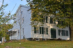
Girard, Ohio
Girard is a city in Trumbull County, Ohio, United States. The population was 9,603 at the 2020 census.[3] It is part of Mahoning Valley.
 | |
 Location of Girard in Trumbull County within the state of Ohio | |
| Coordinates: 41°09′58″N 80°41′46″W / 41.16611°N 80.69611°WCoordinates: 41°09′58″N 80°41′46″W / 41.16611°N 80.69611°W | |
| Country | United States |
| State | Ohio |
| County | Trumbull |
| Area | |
| • Total | 6.10 sq mi (15.81 km2) |
| • Land | 5.64 sq mi (14.61 km2) |
| • Water | 0.46 sq mi (1.20 km2) |
| Elevation | 1,001 ft (305 m) |
| Population | |
| • Total | 9,603 |
| • Density | 1,702.36/sq mi (657.26/km2) |
| Time zone | UTC-5 (EST) |
| • Summer (DST) | UTC-4 (EDT) |
| ZIP code | 44420 |
| FIPS code | 39-30198 |
| GNIS feature ID | 2394903[2] |
| Website | https://cityofgirard.org/ |
References
- ↑ "ArcGIS REST Services Directory". United States Census Bureau. Retrieved September 20, 2022.
- ↑ 2.0 2.1 U.S. Geological Survey Geographic Names Information System: Girard, Ohio
- ↑ 3.0 3.1 "QuickFacts: Girard city, Ohio". United States Census Bureau. Retrieved March 15, 2024.