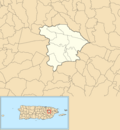
Gurabo, Puerto Rico
Gurabo (Spanish pronunciation: [ɡuˈɾaβo]) is a town and municipality in eastern Puerto Rico.
|
Municipio de Gurabo | |
|---|---|
Town and Municipality | |
 | |
|
| |
| Anthem: "En un valle rodeado por montañas nace un" | |
 Map of Puerto Rico highlighting Gurabo Municipality | |
| Coordinates: 18°15′16″N 65°58′23″W / 18.25444°N 65.97306°WCoordinates: 18°15′16″N 65°58′23″W / 18.25444°N 65.97306°W | |
| Commonwealth | |
| Founded | 1815 |
| Barrios | 10 barrios
|
| Government | |
| • Mayor | Rosachely Rivera (NPP) |
| • Senatorial dist. | 7 - Humacao |
| • Representative dist. | 31,32 |
| Area | |
| • Total | 28.28 sq mi (73.24 km2) |
| • Land | 27.84 sq mi (72.11 km2) |
| • Water | 0.44 sq mi (1.13 km2) |
| Population (2020)[1] | |
| • Total | 40,622 |
| • Density | 1,436.52/sq mi (554.64/km2) |
| Time zone | UTC-4 (AST) |
| ZIP Code | 00778 |
| Major routes | |
| Website | gurabopr.com |
Gurabo, Puerto Rico Media
References
- ↑ "PUERTO RICO: 2020 Census". The United States Census Bureau. Retrieved 2021-08-25.


