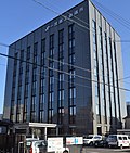
Ichinomiya, Aichi
Ichinomiya (一宮市, Ichinomiya-shi) is a Japanese city in Aichi on the island of Honshu.[1]
|
一宮 | |
|---|---|
| 一宮市 · Ichinomiya | |
| 250px | |
 Location of Ichinomiya in Aichi | |
| Country | Japan |
| Region | Chūbu |
| Prefecture | Aichi |
| Government | |
| • Mayor | Kazuo Tani |
| Area | |
| • Total | 113.91 km2 (43.98 sq mi) |
| Population (October 1, 2005) | |
| • Total | 378,409 |
| • Density | 3,322.00/km2 (8,603.9/sq mi) |
| Time zone | UTC+9 (Japan Standard Time) |
| - Tree | Round-Leaf Holly |
| - Flower | Balloon Flower |
| Address | 2-5-6 Honmachi, Ichinomiya-shi, Aichi-ken 491-8501 |
| Website | City of Ichinomiya |
It has been recognized as a special city since 2001.[2]
History
In the Edo period, Ichinomiya grew up around the Masumida Shrine.[1] It was the chief Shinto shrine (ichinomiya) of Owari Province.[3]
Timeline
- 1889 (Meiji 32): The town was established by the merger of Ichinomiya and Ichishiki.
- September 1, 1921 (Taishō 10): The city was established.
- 1940 (Shōwa 15): Merged with the villages of Haguri and Nishinari.
- 1955 (Shōwa 30): Merged with surrounding 8 municipalities.
- April 1, 2002 (Heisei 14): Ichinomiya became a Special City.
- April 1, 2005 (Heisei 17): Absorbed the city of Bisai and the town of Kisogawa from Haguri District.
Geography
The city is northwest of Nagoya.[1]
Ichinomiya, Aichi Media
愛知県一宮市のモンタージュ画像
- Ichinomiya City Hall 2019-06 ac (1).jpg
愛知県一宮市にある一宮市役所。
- 尾張一宮駅 - panoramio (4).jpg
尾張一宮駅
- DownTown of IchinomiyaCity2.jpg
DownTown of IchinomiyaCity2
- Ichinomiya city i-building exterior ac (1).jpg
Around Owari-Ichinomiya Station
The Kilometre Zero of Ichinomiya
- JP Expressway E1.svg
Alphanumeral road sign for Tōmei Expressway and Meishin Expressway
- JP Expressway E41.svg
Alphanumeral road sign for Tōkai-Hokuriku Expressway
References
- ↑ 1.0 1.1 1.2 Nussbaum, Louis-Frédéric. (2005). "Ichinomiya" in Japan Encyclopedia, p. 371.
- ↑ Jacobs, A.J. "Japan's Evolving Nested Municipal Hierarchy: The Race for Local Power in the 2000s," Urban Studies Research (2011), Table 3; retrieved 2012-12-18.
- ↑ "Nationwide List of Ichinomiya," p. 1 Archived 2013-05-17 at the Wayback Machine; retrieved 2012-3-23.
Other websites
| Wikimedia Commons has media related to Lua error in Module:Commons_link at line 62: attempt to index field 'wikibase' (a nil value).. |
- http://www.city.ichinomiya.aichi.jp/multilingual/ Archived 2012-03-13 at the Wayback Machine, (in Japanese)


