Kradolf-Schönenberg
Kradolf-Schönenberg is a municipality of the district of Weinfelden in the canton of Thurgau in Switzerland.
 Coat of arms | |
Location of Kradolf-Schönenberg
Lua error in Module:Infobox_mapframe at line 118: attempt to index field 'wikibase' (a nil value).
| |
| Coordinates: 47°31′N 9°11′E / 47.517°N 9.183°ECoordinates: 47°31′N 9°11′E / 47.517°N 9.183°E | |
| Country | Switzerland |
| Canton | Thurgau |
| District | Weinfelden |
| Area | |
| • Total | 10.9 km2 (4.2 sq mi) |
| Elevation | 455 m (1,493 ft) |
| Population (December 2005) | |
| • Total | 3,181 |
| • Density | 291.8/km2 (756/sq mi) |
| Time zone | UTC+01:00 (Central European Time) |
| • Summer (DST) | UTC+02:00 (Central European Summer Time) |
| Postal code(s) | 9214, 9215 |
| Surrounded by | Bischofszell, Bürglen, Hohentannen, Niederhelfenschwil (SG), Schönholzerswilen, Sulgen, Wuppenau |
| Website | www SFSO statistics |

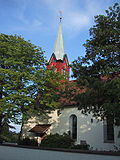
Kradolf-Schönenberg Media

Ruine Anwil in Buhwil TG.

Ruins of the castle of Schönenberg in Kradolf-Schönenberg (Switzerland) at the beginning of the 20th century

Aerial view from 800 m by Walter Mittelholzer (1919)
Aufnahme 15. Juni 2005, Kirche in Neukirch an der Thur TG. Fotograf Peter Berger (selbst fotografiert). Lizenzstatus "GNU-FDL"


