Thurgau
Thurgau is a northeast canton of Switzerland. The population is 228,200 (2003). The capital is Frauenfeld.
| Canton of Thurgau Kanton Thurgau (German) | |
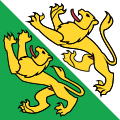
Coat of arms of Coat of arms | |
| Coordinates: 47°35′N 9°4′E / 47.583°N 9.067°ECoordinates: 47°35′N 9°4′E / 47.583°N 9.067°E | |
| Capital | Frauenfeld |
| Subdivisions | 80 municipalities, 5 districts |
| Government | |
| • Executive | Regierungsrat (5) |
| • Legislative | Grosser Rat (130) |
| Area | |
| • Total | 991.77 km2 (382.92 sq mi) |
| Population (December 2020)[2] | |
| • Total | 282,909 |
| • Density | 285.2567/km2 (738.811/sq mi) |
| ISO 3166 code | CH-TG |
| Highest point | 991 m (3,251 ft): Hohgrat |
| Lowest point | 370 m (1,214 ft): Thur at the cantonal border in Neunforn |
| Joined | 1803 |
| Languages | German |
| Website | www |
Geography
To the north of Thurgau is Lake Constance, across which are Germany and Austria. The river Rhine makes the border in the northwest. To the south is the Canton of St. Gallen; to the west are the cantons of Zürich and Schaffhausen.
The area of the canton is 991 km2 and is usually divided into three hilly areas. One of these is along Lake Constance to the north. Another is inland between the rivers Thur and Murg. The third one makes the southern border of the canton and comes together with the Hörnli mountain in the pre-Alps.
History
In prehistoric times the lands of the canton were inhabited by people of the Pfyn culture along the lake. During Roman times the canton was part of the province Raetia until in 450 the lands were settled by the Alamanni. It was only in the 8th century that the canton became a political unit similar to what it is known today, as a Gau of the Frankish Empire. At the time, however, the area was not so clearly defined and changed frequently. Overall, the size of the Thurgau was larger, but during the Middle Ages the canton became smaller in size. The dukes of Zähringen and the counts of Kyburg took over much of the land. The town of Zürich was part of the Thurgau until it became reichsunmittelbar in 1218. When the Kyburg dynasty became extinct in 1264 the Habsburgs took over that land. The Swiss confederation allied with ten freed bailiwicks of the former Toggenburg seized the lands of the Thurgau from the Habsburgs in 1460, and it became subject territory of Zürich.
In 1798 the land became a canton for the first time as part of the Helvetic Republic. In 1803 the canton of Thurgau became a member of the Swiss confederation. The current cantonal constitution dates from 1987.
Economy
The canton of Thurgau is known for farm produce such as apples, pears, and other fruits and vegetables. The many orchards in the canton are used for the making of cider. Wine is produced in the Thur valley.
There is also industry in the canton of Thurgau. The main industries are printing, clothing and arts and crafts. Small and middle-sized businesses are important for the economy. Many of these are concentrated around the capital.
Demographics
The population is mostly German speaking. Most of the population are Protestants with the rest being Roman Catholics.
Districts
The Canton of Thurgau is divided into eight districts, and each is named after its capital:
- Steckborn with capital Steckborn.
- Frauenfeld with capital Frauenfeld.
- Kreuzlingen with capital Kreuzlingen.
- Weinfelden with capital Weinfelden.
- Bischofszell with capital Bischofszell.
- Diessenhofen with capital Diessenhofen.
- Münchwilen with capital Münchwilen.
- Arbon with capital Arbon.
Municipalities
There are 80 municipalities in the canton (as of April 2004):
Thurgau Media
View of Untersee (Lake Constance) near Eschenz with the German shore beyond. Lake Constance and the river Rhine mark the northern border of the canton.
- Karte Kanton Thurgau Bezirke 2011.png
The five districts, since 2011
The eight former districts, prior to 2011
References
- ↑ Arealstatistik Land Cover - Kantone und Grossregionen nach 6 Hauptbereichen accessed 27 October 2017
- ↑ "Ständige und nichtständige Wohnbevölkerung nach institutionellen Gliederungen, Geburtsort und Staatsangehörigkeit". bfs.admin.ch (in Deutsch). Swiss Federal Statistical Office - STAT-TAB. 31 December 2020. Retrieved 21 September 2021.
Other websites
| Wikimedia Commons has media related to Lua error in Module:Commons_link at line 62: attempt to index field 'wikibase' (a nil value).. |
- Official site (in German)
- Official statistics
