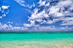
Punta Cana
Punta Cana, named after a local cape, is a region in the easternmost tip of the Dominican Republic. Covering about 4,200,000 m2 (about 1,100 acres), the region is home to a coastline of sandy white beaches and to a town of the same name. A region once named Punta de Borrachón was merged with Punta Cana by the founding investors in 1969.
 | |
| Coordinates: 18°32′00″N 68°22′00″W / 18.5333°N 68.3667°WCoordinates: 18°32′00″N 68°22′00″W / 18.5333°N 68.3667°W |
Punta Cana Media
Frank Rainieri with his family.
- Punta Cana-29.07.1999-Landsat 7 ETM+ L2 True Color.jpg
Satellite image of Punta Cana (1999)
- Punta Cana-02.03.2018- Sentinel-2 L2A True color.jpg
Satellite image of Punta Cana (2018)


