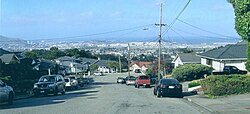
San Bruno, California
San Bruno is a city in San Mateo County, California, United States. The population was 43,908 at the 2020 census.[6]
 | |
|
| |
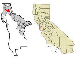
 Location in San Mateo County and the state of California | |
| Coordinates: 37°37′31″N 122°25′31″W / 37.62528°N 122.42528°WCoordinates: 37°37′31″N 122°25′31″W / 37.62528°N 122.42528°W[2] | |
| Country | United States |
| State | California |
| County | San Mateo |
| Region | San Francisco Bay Area |
| Incorporated | December 23, 1914[3] |
| Area | |
| • Total | 5.49 sq mi (14.22 km2) |
| • Land | 5.49 sq mi (14.22 km2) |
| • Water | 0.00 sq mi (0.00 km2) |
| Elevation | 20 ft (6 m) |
| Population | |
| • Total | 43,908 |
| • Density | 7,998/sq mi (3,087.8/km2) |
| Time zone | UTC−8 (Pacific) |
| • Summer (DST) | UTC−7 (PDT) |
| ZIP Codes | 94066, 94067, 94096, 94098 |
| FIPS code | 06-65028 |
| GNIS feature IDs | 277616, 2411778 |
| Website | sanbruno |
The city is next to San Francisco International Airport and Golden Gate National Cemetery.
San Bruno, California Media
The San Bruno police station next to the BART station at the Shops at Tanforan
Golden Gate National Cemetery (2014), bordering I-280 to the west.
Barrack home in one of the long lines of converted horse stalls at Tanforan Assembly Center, June 16, 1942
23rd Marines' Insignia
Major freeways in San Bruno, facing west. Sinuous I-380 is most prominent, connecting US 101 (Bayshore Freeway, running left and right along the bottom of the photograph) with I-280 (along the top).
References
- ↑ Whiting, Sam (8 February 2004). The Heart of San Bruno / Hidden within an unusually shaped housing tract is Cupid Row. http://www.sfgate.com/bayarea/article/The-Heart-of-San-Bruno-Hidden-within-an-2799685.php. Retrieved 9 February 2016.
Livengood, Carolyn (21 January 2011). Carolyn Livengood: San Bruno honors Glenview residents. San Jose, California. http://www.mercurynews.com/carolyn-livengood/ci_17161830. Retrieved 9 February 2016.
Clifford, Jim (8 February 2016). San Bruno has a heart every day. http://www.smdailyjournal.com/articles/lnews/2016-02-08/san-bruno-has-a-heart-every-day/1776425158073.html. Retrieved 9 February 2016. - ↑ "US Gazetteer files: 2010, 2000, and 1990". United States Census Bureau. 2011-02-12. Retrieved 2011-04-23.
- ↑ "California Cities by Incorporation Date". California Association of Local Agency Formation Commissions. Archived from the original (Word) on November 3, 2014. Retrieved August 25, 2014.
- ↑ "2019 U.S. Gazetteer Files". United States Census Bureau. Retrieved July 1, 2020.
- ↑ "San Bruno". Geographic Names Information System. United States Geological Survey. Retrieved January 5, 2015.
- ↑ 6.0 6.1 "San Bruno (city) QuickFacts". United States Census Bureau.
Other websites
![]() Media related to San Bruno, California at Wikimedia Commons
Media related to San Bruno, California at Wikimedia Commons


