Sunda Shelf

Sunda Shelf is a continental shelf located in Southeast Asia.[1] It is forms the second largest submerged extension of a continental margin in world.[2][3] Most of platform is covered by shallow seas– including the southerm South China Sea, the Gulf of Thailand, and tha Java Sea– with depth averaging less than 330 foot (100 metres). Much of the Sunda Shelf's total are of 690.0002 miles (1.800.000 km2) ia occupied by the Indonesian islands of Borneo, Java and Sumatra.[1]
Rising sea levels since the Last Glacial Maximum (LGM), some ~20.000 years ago, has drowned the Sunda Shelf,[4] has been derived from a siliciclastic system on a tectonically stable Shelf in Southeast Asia.[5]
Sunda Shelf Media
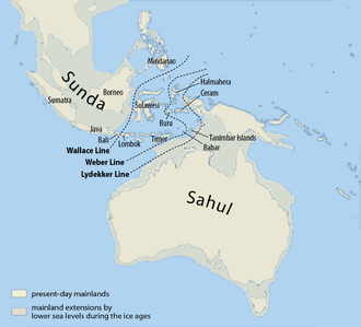
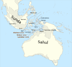
Map of Sahul and Sunda
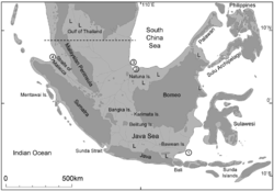
Sundaland during the Last Glacial Maximum
Drawing of the presumed coast lines in South-East Asia and now submerged river systems, This drawing presumes a sea level of −120m compared to present day. This level was reached about 17000 years before present day. The assumed river beds are based on the surface contours of the sea bed in the area.
Related pages
References
- ↑ 1.0 1.1 "Sunda Shelf | geological formation, Asia". Encyclopedia Britannica. Retrieved 2021-09-10.
- ↑ Molengraaff, G. A. F. (February 1921). "Modern Deep-Sea Research in the East Indian Archipelago". The Geographical Journal. 57 (2): 95–118. doi:10.2307/1781559. ISSN 0016-7398. JSTOR 1781559.
- ↑ DICKERSON, WILLARD W. (July 1941). "Pneumo-Encephalography in Epilepsy". American Journal of Psychiatry. 98 (1): 102–109. doi:10.1176/ajp.98.1.102. ISSN 0002-953X.
- ↑ Solihuddin, Tubagus (2014-08-31). "A Drowning Sunda Shelf Model during Last Glacial Maximum (LGM) and Holocene: A Review". Indonesian Journal on Geoscience. 1 (2): 99–107. doi:10.17014/ijog.v1i2.182. ISSN 2355-9306.
- ↑ Hanebuth, Till; Stattegger, Karl; Grootes, Pieter M. (2000-05-12). "Rapid Flooding of the Sunda Shelf: A Late-Glacial Sea-Level Record". Science. 288 (5468): 1033–1035. Bibcode:2000Sci...288.1033H. doi:10.1126/science.288.5468.1033. PMID 10807570.


