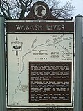
Wabash River
The Wabash River /ˈwɔːbæʃ/ (French: Ouabache) is a 503-mile-long (810 km)[1] river in the Midwestern United States that flows southwest from northwest Ohio near Fort Recovery across northern Indiana to southern Illinois.
It forms the Illinois-Indiana border before draining into the Ohio River, of which it is the largest northern tributary. From the dam near Huntington, Indiana to its terminus at the Ohio River, the Wabash flows freely for 411 miles (661 km).
Wabash River Media
A scene along the Wabash River, sketched in 1778 by Lt Governor Henry Hamilton en route to recapture Vincennes, Indiana during the American Revolutionary War
The former course of the Wabash River, running by the former site of the original Fort Recovery; the reproduction can be seen in the background, but it is not the original fort
- Forks of the Wabash.jpg
Forks of the Wabash at Huntington, Indiana
- Peru Wabash Steel Truss Bridge 2022.jpg
U.S. Route 31 Business crossing of the Wabash River in Peru, Indiana
- Sunset Point near Delphi.jpg
Sunset Point at Delphi, where Deer Creek joins the Wabash
- Wabash River.jpg
The Wabash River by Covington, Indiana
- Wabash River at Williamsport.png
The Wabash River alongside Williamsport, Indiana
- Sagamore Pkwy Bridge demolition.jpg
Demolition of the U.S. 52 bridge over the Wabash River 2016
- Wabash inlet and island.JPG
A small island and water fowl wildlife refuge in the Wabash near Mount Carmel, Illinois
References
- ↑ U.S. Geological Survey. National Hydrography Dataset high-resolution flowline data. The National Map Archived 2017-08-23 at the Wayback Machine, accessed May 13, 2011
Other websites
![]() Media related to Wabash River at Wikimedia Commons
Media related to Wabash River at Wikimedia Commons
