Walnut, California
(Redirected from Walnut, CA)
Walnut is a city in Los Angeles County in the U.S. state of California.[6] During the 2020 census, the city had a population of 28,430.[4]
 | |
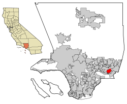
 Location of Walnut in Los Angeles County, California | |
| Coordinates: 34°2′N 117°52′W / 34.033°N 117.867°WCoordinates: 34°2′N 117°52′W / 34.033°N 117.867°W | |
| Country | United States |
| State | California |
| County | Los Angeles |
| Incorporated (city) | January 19, 1959[1] |
| Named for | Rancho Los Nogales (English: Ranch of the Walnut Trees) |
| Area | |
| • Total | 8.99 sq mi (23.29 km2) |
| • Land | 8.99 sq mi (23.28 km2) |
| • Water | 0.00 sq mi (0.01 km2) 0.04% |
| Elevation | 561 ft (171 m) |
| Population | |
| • Total | 28,430 |
| • Density | 3,162.4/sq mi (1,220.7/km2) |
| Time zone | UTC-8 (PST) |
| • Summer (DST) | UTC-7 (PDT) |
| ZIP Codes | 91788, 91789, 91795[5] |
| FIPS code | 06-83332 |
| GNIS feature IDs | 1652808, 2412173 |
| Website | www |
Walnut, California Media
Californio ranchero Ricardo Vejar owned both Rancho Los Nogales and part of Rancho San José, which make up modern-day Walnut.
Olympic Flame and wall of honor at Hilmer Lodge Stadium
References
- ↑ "California Cities by Incorporation Date". California Association of Local Agency Formation Commissions. Archived from the original (Word) on November 3, 2014. Retrieved August 25, 2014.
- ↑ "2020 U.S. Gazetteer Files". United States Census Bureau. Retrieved March 15, 2022.
- ↑ "Walnut". Geographic Names Information System. United States Geological Survey. Retrieved February 23, 2015.
- ↑ 4.0 4.1 "QuickFacts: Walnut city, California". United States Census Bureau. Retrieved August 28, 2023.
- ↑ "USPS - ZIP Code Lookup - Find a ZIP+ 4 Code By City Results". Retrieved January 18, 2007.
- ↑ "About the City of Walnut". Archived from the original on June 5, 2016. Retrieved March 10, 2015.

