Bioko
Bioko is an island 32 km (20 mi) off the west coast of Africa. It is the northernmost part of Equatorial Guinea. It is in the Bight of Bonny part of the Gulf of Guinea.
| Geography | |
|---|---|
| Location | Gulf of Guinea |
| Coordinates | 3°30′N 8°42′E / 3.500°N 8.700°ECoordinates: 3°30′N 8°42′E / 3.500°N 8.700°E |
| Area | 2,017 km2 (779 sq mi) |
| Length | 70 km (43 mi) |
| Width | 32 km (20 mi) |
| Elevation | 3,012 m (9,882 ft) |
| Country | |
Equatorial Guinea | |
| Demographics | |
| Population | 334,463 |
| Density | 165.8/km2 (429/sq mi) |
Bioko has a total area of 2,017 km2 (779 sq mi). It is 70 km (43 mi) long and about 32 km (20 mi) across. Its highest peak is Pico Basile at 3,012 m (9,882 ft).
Bioko Media
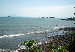
Bioko in the distance from Limbe, Cameroon
1908 map of Fernando Po and the coast of Cameroons
References
| Wikimedia Commons has media related to Lua error in Module:Commons_link at line 62: attempt to index field 'wikibase' (a nil value).. |
| Wikivoyage has a travel guide about: Bioko |


