Bowery

Bowery, (commonly called The Bowery) is the name of a street and a small neighborhood in the southern Manhattan. The name comes from the Dutch bouwerij, which is an old word for "farm." The neighborhood is surrounded by the East Village to the north, Canal Street and Chinatown to the South, Allen Street and the Lower East Side to the east and Little Italy to the west. The area was home to many Irish immigrants in the early 19th century after the Great Irish Famine.
Lua error in Module:Attached_KML at line 224: attempt to index field 'wikibase' (a nil value).
Bowery Media
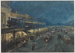
Looking north from Grand Street, showing the tracks of the Third Avenue Elevated, c. 1910
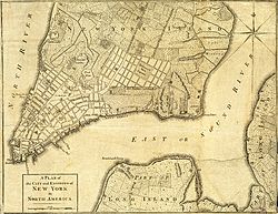
The Bowery (unmarked), leading to the "Road to Kings Bridge, where the Rebels mean to make a Stand" in a British map of 1776
The Bull's Head Tavern in the Bowery, 1801 – c. 1860
Berenice Abbott photograph of a Bowery restaurant in 1935, when the street was lined with flophouses
Steve Brodie's bar at 114 Bowery


