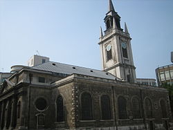
Cheap (ward)
Coordinates: 51°30′53″N 0°05′38″W / 51.5148°N 0.094°W
Cheap (meaning market[1]) is a small ward of the City of London.
Ward of Cheap | |
Ward of Cheap shown within Greater London | |
OS grid reference | TQ321812 |
---|---|
Sui generis | City of London |
Administrative area | Greater London |
Region | London |
Country | England |
Sovereign state | United Kingdom |
Post town | LONDON |
Postcode district | EC1, EC4 |
Dialling code | 020 |
Police | City of London |
Fire | London |
Ambulance | London |
EU Parliament | London |
UK Parliament | Cities of London and Westminster |
London Assembly | City and East |
Cheap (ward) Media
References
- ↑ cheap, n., I.2.b., Oxford English Dictionary, Second Edition, 1989, Oxford University Press.
Other websites
- Map of Early Modern London: Cheap Ward Archived 2011-10-03 at the Wayback Machine - Historical Map and Encyclopedia of Shakespeare's London (Scholarly)
- Corporation of London Archived 2011-07-04 at the Wayback Machine Cheap ward boundaries