Denton County, Texas
Denton County is a county in the U.S. state of Texas. In 2020, 906,422 people lived there.[1] The county seat is Denton.
| Denton County, Texas | |
| Map | |
| Map of Texas highlighting Denton County Location in the state of Texas | |
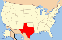
 Texas's location in the U.S. | |
| Statistics | |
| Founded | April 11, 1846 |
|---|---|
| Seat | Denton |
| Largest City | Denton |
| Area - Total - Land - Water |
953 sq mi (2,468 km²) 878 sq mi (2,274 km²) 75 sq mi (194 km²), 7.8 |
| Population - (2020) - Density |
906,422 auto/sq mi (Expression error: Unrecognized word "auto"./km²) |
| Time zone | Central: UTC-6/-5 |
| Website: https://dentoncounty.gov/ | |
| Named for: John B. Denton | |
History
The county was made in 1846. It was named after John B. Denton.
Geography
The county has a total area of 953 square miles.
Schools
These school districts are in Denton County:
Places
Cities
- Argyle
- Aubrey
- Corinth
- Denton (county seat)
- Highland Village
- Little Elm
Denton County, Texas Media
- University of North Texas September 2015 11 (Hurley Administration Building).jpg
Hurley Administration Building of UNT.
References
- ↑ "Denton County, Texas". United States Census Bureau. Retrieved August 5, 2023.