McMahon Line

The McMahon Line is a demarcation line drawn on map referred to in the Simla Convention, a treaty between Britain and Tibet signed in 1914.[1]
Although its legal status is disputed, it is currently the effective boundary between China and India.[2]
This dispute was used a pretext in a war between China and India in 1962.[3]
McMahon Line Media
The western portion of the McMahon line drawn on Map 1, that was shared by the British and the Tibetan delegates at the Simla Conference, 1914
The eastern portion of the McMahon line drawn on Map 2, that was shared by the British and the Tibetan delegates at the Simla Conference, 1914
Painting of Henry McMahon, either taken in 1901or 1915 according to conflicting sources
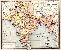
Map of the British Indian Empire from the Imperial Gazetteer of India, 1909 showing the Outer Line as the border of Assam.[a]
1907 map of East Bengal and Assam from the Imperial Gazetteer of India showing the Outer Line as the border
- BritishIndianEmpireandEnvirons2.jpg
Map of "The Indian Empire and surrounding countries", from Imperial Gazetteer of India, shows the "Outer line" as the boundary between the British India and the Chinese Empire.
- North-East Frontier in 1947 Political Map of India.jpg
The northeast section of the 1947 political map of India, showing the McMahon Line as the boundary
McMahon Line Simla Accord Treaty 1914 Map1.jpg
McMahon Line, Simla Accord,treaty signed in 1914, Map 2
Related pages
References
- ↑ Chellaney, Brahma. "India-China: Let facts speak for themselves," The Economic Times (Mumbai). 17 September 2010; retrieved 2012-5-12.
- ↑ "China rejects report on border talks with India," Xinhua News Agency, August 7, 2009; Guruswamy, Mohan. "The Battle for the Border," Rdiff.com (India). 23 June 2003; retrieved 2012-5-12.
- ↑ "A Himalayan rivalry," The Economist (UK). 19 August 2010; retrieved 2012-5-12.
- ↑ Mehra, The McMahon Line and After 1974, p. 10.
Further reading
- GlobalSecurity.org, India-China Border Dispute
- Kawaguchi, Yuki. "Arunachal Pradesh Territorial Dispute between India and China," Archived 2010-10-01 at the Wayback Machine ICE Case Studies (US). No. 161, November, 2005.
Cite error: There are <ref> tags on this page, but the references will not show without a {{Reflist|group=lower-alpha}} template or a <references group="lower-alpha"/> tag.
