Missoula County, Montana
Missoula County is a county found in the State of Montana. As of the 2020 United States Census, the population was 117,922,[1] making it Montana's third-most populous county. Its county seat and largest city is Missoula.[2] It was created in 1860.[3]
| Missoula County, Montana | |
| Map | |
 Location in the state of Montana | |
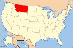
 Montana's location in the U.S. | |
| Statistics | |
| Founded | December 14, 1860 |
|---|---|
| Seat | Missoula |
| Largest City | Missoula |
| Area - Total - Land - Water |
2,618 sq mi (6,781 km²) 2,593 sq mi (6,716 km²) 25 sq mi (65 km²), 1.0 |
| Population - Density |
|
| Time zone | Mountain: UTC-7/-6 |
| Website: www.missoulacounty.us | |
| * Montana county number 04 | |
References
- ↑ "QuickFacts: Missoula County, Montana". United States Census Bureau. Retrieved January 5, 2024.
- ↑ "Find a County". National Association of Counties. Retrieved 7 June 2011.
- ↑ "Montana Place Names Companion". Montana Place Names From Alzada to Zortman. Montana Historical Society Research Center. Retrieved December 1, 2014.