Orange Walk District
Orange Walk District is a district in the northwest of the nation of Belize. The district capital is Orange Walk Town. The population was 45,419 persons in 2010.
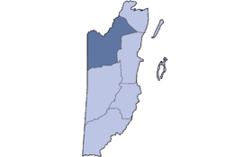
 Location of the district in Belize | |
| Coordinates: 17°50′N 88°50′W / 17.833°N 88.833°WCoordinates: 17°50′N 88°50′W / 17.833°N 88.833°W | |
| Country | |
| Capital | Orange Walk Town |
| Population (2010)[1] | |
| • Total | 45,419 |
The Rio Bravo Conservation and Management Area, a large private nature reserve in the Yalbac Hills, is in this district. The land is highly cultivated with sugar cane, sorghum, rice, corn and vegetables. A lot of this agriculture is done by Mennonite farmers.
The district is home to mostly Maya mestizo descendants of Mexican refugees who fled from the 1840 Caste War.
Tourism is growing. This is due to healthy populations of tropical wildlife and the rich archaeological sites. There are over 400 recorded bird species in the district. The district has two rivers, the Rio Hondo and the New River.
References
- ↑ "Mid‐Year Population by District and Sex, 2009" (PDF). Statistical Institute of Belize.