Orangeville, Ontario
Orangeville (Canada 2021 Census 30,167) is a town in south-central Ontario, Canada. It is the seat of Dufferin County.
| Town of Orangeville | |
 | |
|
| |
 Location of Orangeville within Dufferin County | |
| Coordinates: 43°54′55″N 80°06′31″W / 43.91528°N 80.10861°WCoordinates: 43°54′55″N 80°06′31″W / 43.91528°N 80.10861°W | |
| Country | Canada |
| Province | Ontario |
| County | Dufferin |
| Incorporated | 1863 (village) |
| Incorporated | 1873 (town) |
| Government | |
| • Type | Mayor-council government |
| • Mayor | Lisa Post |
| • Deputy Mayor | Todd Taylor |
| • Councillors | Joe Andrews, Andy Macintosh, Tess Predergast, Debbie Sherwood, Rick Stevens |
| Area | |
| • Land | 15.16 km2 (5.85 sq mi) |
| • Urban | 19.77 km2 (7.63 sq mi) |
| Elevation | 411.50 m (1,350.07 ft) |
| Population (2021)[1] | |
| • Town (lower-tier) | 30,167 |
| • Density | 1,989.5/km2 (5,153/sq mi) |
| • Urban | 34,177 |
| • Urban density | 1,728.9/km2 (4,478/sq mi) |
| Time zone | UTC-5 (EST) |
| • Summer (DST) | UTC-4 (EDT) |
| Forward sortation area | |
| Highways | |
| Website | www |
Orangeville, Ontario Media

The house of Orangeville founder Orange Lawrence as it stands today

Businesses on Broadway through downtown Orangeville
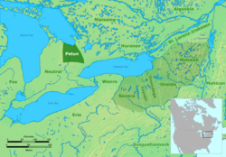
Territory of the Petún (Tionontati) people.

- Orangevilletownhallnov

Built c. 1871, the town hall contains the opera hall


References
- ↑ 1.0 1.1 "Census Profile, 2021 Census - Orangeville, Town [Census subdivision], Ontario and Orangeville [Population centre], Ontario". Statistics Canada. February 9, 2022. Retrieved April 25, 2025.
- ↑ Canadian Climate Normals 1971-2000, Environment Canada. Retrieved May 19, 2012.