Platte County, Wyoming
Platte County is a county in the U.S. state of Wyoming. As of the 2020 census, 8,605 people lived there.[1] Its county seat is Wheatland.[2]
| Platte County, Wyoming | |
| Map | |
 Location in the state of Wyoming | |
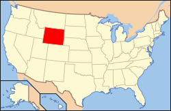
 Wyoming's location in the U.S. | |
| Statistics | |
| Founded | February 21, 1911 (authorized) 1913 (organized) |
|---|---|
| Seat | Wheatland |
| Largest City | Wheatland |
| Area - Total - Land - Water |
2,111 sq mi (5,467 km²) 2,084 sq mi (5,398 km²) 27 sq mi (70 km²), 1.3% |
| Population - Density |
|
| Time zone | Mountain: UTC-7/-6 |
| Website: plattecountywyoming.com | |
| Named for: North Platte River | |
| County flag | 
|
History
Platte County was created on February 21, 1911.[3] The county was named for the North Platte River, which flows through the northeastern part of the county.[4]
Geography
According to the US Census Bureau, the county has a total area of 2,111 square miles (5,470 km2), of which 2,084 square miles (5,400 km2) is land and 27 square miles (70 km2) (1.3%) is water.[5] It is the third-smallest county in Wyoming by area.
Bordering counties
- Niobrara County (northeast)
- Goshen County (east)
- Laramie County (south)
- Albany County (west)
- Converse County (northwest)
Communities
Towns
Census-designated places
Unincorporated communities
- Bordeaux
- Diamond
- Dwyer
- Dwyer Junction
- Uva
- Wendover
Ghost towns
References
- ↑ "QuickFacts: Platte County, Wyoming". United States Census Bureau. Retrieved January 21, 2024.
- ↑ "Find a County". National Association of Counties. Retrieved June 7, 2011.
- ↑ Long, John H., ed. (2004). "Wyoming: Individual County Chronologies". Wyoming Atlas of Historical County Boundaries. The Newberry Library. Archived from the original on August 3, 2015. Retrieved August 19, 2015.
- ↑ Urbanek, Mae (1988). Wyoming Place Names. Missoula MT: Mountain Press Pub. Co. ISBN 0-87842-204-8.
- ↑ "2010 Census Gazetteer Files". US Census Bureau. August 22, 2012. Retrieved August 18, 2015.
Other websites
| Wikimedia Commons has media related to Lua error in Module:Commons_link at line 62: attempt to index field 'wikibase' (a nil value).. |