Troutville, Virginia
Troutville, Virginia is a town in the U.S. state of Virginia.
 | |
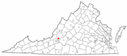
 Location of Troutville, Virginia | |
| Coordinates: 37°24′55″N 79°52′37″W / 37.41528°N 79.87694°WCoordinates: 37°24′55″N 79°52′37″W / 37.41528°N 79.87694°W | |
| Country | United States |
| State | Virginia |
| County | Botetourt |
| Area | |
| • Total | 0.69 sq mi (1.79 km2) |
| • Land | 0.69 sq mi (1.79 km2) |
| • Water | 0.00 sq mi (0.00 km2) |
| Elevation | 1,391 ft (424 m) |
| Population (2020) | |
| • Total | 458 |
| • Density | 663.77/sq mi (255.87/km2) |
| Time zone | UTC-5 (Eastern (EST)) |
| • Summer (DST) | UTC-4 (EDT) |
| ZIP code | 24175 |
| FIPS code | 51-79472[2] |
| GNIS feature ID | 1493720[3] |
| Website | https://townoftroutville-va.gov/ |
Troutville, Virginia Media
References
- ↑ "2019 U.S. Gazetteer Files". United States Census Bureau. Retrieved August 7, 2020.
- ↑ "U.S. Census website". United States Census Bureau. Retrieved 2011-05-14.
- ↑ "Troutville". Geographic Names Information System. United States Geological Survey.
