United States Geological Survey
The United States Geological Survey (USGS) is a scientific agency of the United States government. The agency is a part of the United States Department of the Interior.
| United States Geological Survey (USGS) | |
|---|---|

| |
| Seal of the United States Geological Survey | |

| |
| Official identifier of the U.S. Geological Survey | |

| |
| Flag of the United States Geological Survey | |
| Agency overview | |
| Formed | March 3, 1879 (as Geological Survey) |
| Jurisdiction | United States |
| Headquarters | John W. Powell National Center Reston, Virginia, U.S. |
| Employees | 8,670 (2009) |
| Annual budget | $1.16 billion (FY2019) [1] |
| Agency executive | Dave Applegate[2], Acting Director |
| Parent agency | United States Department of the Interior |
| Website | |
| USGS.gov | |
The scientists of the USGS study the landscape of the United States, its natural resources, and the natural hazards that threaten it. The organization has four major science disciplines: biology, geography, geology, and hydrology. The USGS is a fact-finding research organization. It has no power to regulate.
The USGS science focus is on seven "Mission Areas", (1) Climate and land use change, (2) Core science systems, (3) Ecosystems, (4) Energy and minerals, (5) Environmental health, (6) Natural hazards, and (7) Water.[3][4]
Administratively, it is divided into a Headquarters unit and six Regional Units.[5] Other specific programs include:
Earthquakes
The USGS Earthquake Hazards Program monitors earthquake activity worldwide. Its National Earthquake Information Center (NEIC) in Golden, Colorado detects the location and magnitude of global earthquakes. The USGS also runs or supports several regional monitoring networks in the U.S. under the umbrella of the Advanced National Seismic System Archived 2009-10-28 at the Wayback Machine (ANSS). The USGS informs authorities, emergency responders, the media, and the public, both domestic and worldwide, about significant earthquakes. It also maintains long-term archives of earthquake data for scientific and engineering research. It also conducts and supports research on long-term seismic hazards.
The USGS operates the streamgaging network for the United States, with over 7400 streamgages. Real-time streamflow data are available online. The motto of the USGS is "Science for a changing world."[6]
| Wikimedia Commons has media related to Lua error in Module:Commons_link at line 62: attempt to index field 'wikibase' (a nil value).. |
United States Geological Survey Media
A USGS gauging station on the Scioto River below O'Shaughnessy Dam near Dublin, Ohio
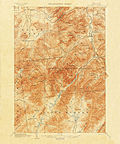
An 1892 15-minute map of Mount Marcy in the Adirondacks in New York state from the late 19th century
United States Geological Survey marker on the summit of Maiden Peak (Washington)
Other websites
| Website |
|---|
| USGS official site |
| Major USGS sites: Water, Geology Archived 2009-08-12 at the Wayback Machine, Geography Archived 2006-12-29 at the Wayback Machine, Biology Archived 2010-11-12 at the Wayback Machine |
References
- ↑ H.J.Res. 31
- ↑ "Dave Applegate, Ph.D." U.S. Geological Survey. Retrieved 11 March 2021.
- ↑ "Start with science". United States Geological Survey. Retrieved October 3, 2012.
- ↑ Energy and Minerals Archived 2019-04-01 at the Wayback Machine and Environmental Health Archived 2018-02-18 at the Wayback Machine
- ↑ "Map of geographic areas". Archived from the original on January 15, 2013. Retrieved December 12, 2012.
- ↑ "USGS Visual Identity System". July 27, 2006. Archived from the original on 2009-01-30. Retrieved 2008-12-29.


